Friendsville in Garrett County, Maryland — The American Northeast (Mid-Atlantic)
The Unique Milling Company
In anticipation of the millworks arrival, Leslie Friend developed a hydroelectric plant using water from an impoundment left idle by the old iron forge on the west side of the river across from the park. A water wheel powered generator sent electricity on wires to the ill, which distributed the power to street lights, businesses and private homes. At this time at the turn of the century, very few rural communities had pwoer. The power to the town and the mill was shut off at 9 p.m. Homes had simple lighting with a single bulb hanging down from the ceiling.
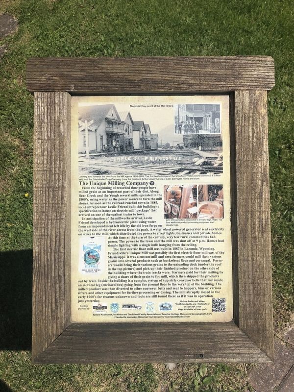
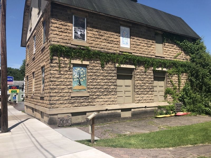
The first electric flour mill was built in 1887 in Laramie, Wyoming. Friendsville's Unique Mill was possibly the first electric flour mill east of the Mississippi. It was a custom mill and area farmers could mill their various grains into several products such as buckwheat flour and cornmeal. Farmers would bring their various grains to the unloading dock (under the roof in the top picture) and pick up their finished product on the other side of the building where the train tracks were. Farmers paid for their milling by giving a share of their grain to the mill, which then shipped the products out by the train. Inside the building is a complex system of cup style conveyor belts that run inside an elevator leg (enclosed box) going from the ground floor to the very top of the building. The milled product was then diverted to other conveyor belts and sent to hoppers, bias or various sifters and other equipment for further processing or drying. The mill abruptly closed in the early 1960's for reasons unknown and tools are still found there as if it was in operation just yesterday.
[Captions:]
Looking east towards the river from the Mill approx. 1895-1905. The first two buildings on the left where Wolfes Store (current S & S Market) and the Friendsville Drug Company (now the Pub) and further down the street Cecil Schroyers home and store.
Left: Milling machine connected to elevator legs. Right: Top floor additional product processing equipment and elevator legs.
Erected by Maryland Heritage Area Authority. (Marker Number 10.)
Topics and series. This historical marker is listed in these topic lists: Industry & Commerce
Location. 39° 39.829′ N, 79° 24.337′ W. Marker is in Friendsville, Maryland, in Garrett County. Marker is on Maple Street west of 1st Avenue, on the right when traveling west. Touch for map. Marker is at or near this postal address: 833 1st Avenue, Friendsville MD 21531, United States of America. Touch for directions.
Other nearby markers. At least 8 other markers are within walking distance of this marker. First National Bank, Leslie Friend Store & Military Honors (a few steps from this marker); Friendsville Honor Roll (a few steps from this marker); Yough Motors, Confectionary and Bandstand (within shouting distance of this marker); Morris Avenue and Maple Street (about 300 feet away, measured in a direct line); The Railroad Era and Hotels (about 400 feet away); Walnut Street and First Avenue – F.G. Fox & Sons (about 500 feet away); Friendsville Commerce, Custer's and Ryland's Stores (about 600 feet away); Water Street North, Captain Elijah Monroe Friend (about 600 feet away). Touch for a list and map of all markers in Friendsville.
Credits. This page was last revised on July 19, 2020. It was originally submitted on May 25, 2019, by Devry Becker Jones of Washington, District of Columbia. This page has been viewed 154 times since then and 11 times this year. Photos: 1, 2. submitted on May 25, 2019, by Devry Becker Jones of Washington, District of Columbia.

