National Park in Gloucester County, New Jersey — The American Northeast (Mid-Atlantic)
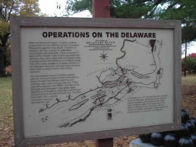
Operations on the Delaware
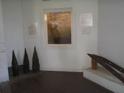
When the Revolution began, Congress ordered construction of river defense systems to protect Philadelphia against a sea attack. A system of cheveaux-de-fries, a series of underwater obstructions, was developed. These consisted of large coffers (boxes) made of pine logs lined with planking. Long, heavy poles with iron tipped spikes projected out of the coffers at a 45 degree angle. The coffers were floated to strategic positions in the Delaware, filled with rock and sunk just below water level to impale enemy ships sailing upstream.
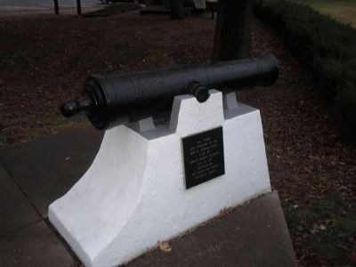
The Pennsylvania Council of Safety oversaw planning and construction of the fortifications, which included the cheveaux-de-fries, land batteries, and a navy to guard the river. Three sites were selected: Fort Mifflin, Fort Mercer at Red Bank and Billingsport. Row galleys were designed by Philadelphia shipwrights and formed the backbone of the Pennsylvania navy. The fifty-foot boats, with a cannon mounted in the bow, patrolled the river.
On October 23, 1777, the day after the victory at Red Bank, the 64 gun British warship Augusta exploded and sank down river under heavy American attack. The similar loss of the Merlin, a sloop carrying 18 cannons, and the victory of Colonel Christopher Greene delayed the British attempt to clear the river defenses.
Erected by Red Bank Historical Park.
Topics. This historical marker is listed in these topic lists: Notable Events • Notable Places • War, US Revolutionary. A significant historical month for this entry is October 1777.
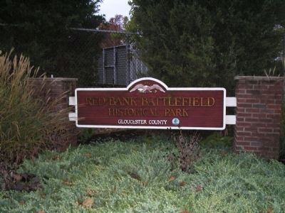
Location. 39° 52.153′ N, 75° 11.411′ W. Marker is in National Park, New Jersey, in Gloucester County. Marker is on Hessian Road, on the left when traveling west. Marker is in Red Bank Battlefield. Touch for map. Marker is in this post office area: National Park NJ 08063, United States of America. Touch for directions.
Other nearby markers. At least 8 other markers are within walking distance of this marker. James and Ann Whitall House (a few steps from this marker); Ann Cooper Whitall (within shouting distance of this marker); The Medicinal Garden (within shouting distance of this marker); Welcome to Red Bank Battlefield Park! (within shouting distance of this marker); National Park Armed Service Monument (within shouting distance of this marker); Welcome to Red Bank Battlefield (within shouting distance of this marker); Whitall House (within shouting distance of this marker); The Aftermath (within shouting distance of this marker). Touch for a list and map of all markers in National Park.
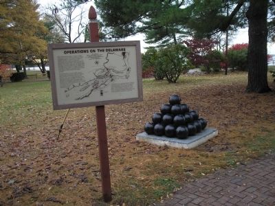
More about this marker. The marker contains a map showing the course of the Delaware River from Philadelphia to Chester with the several forts and stackadoes fortified by the Rebels, and the attacks made by His Majesty’s Land and Sea forces.
Also see . . .
1. Battle of Red Bank. Wikipedia entry (Submitted on October 15, 2023, by Larry Gertner of New York, New York.)
2. Red Bank Battlefield Park and the Whitall House. Visit South Jersey website entry (Submitted on October 15, 2023, by Larry Gertner of New York, New York.)
Credits. This page was last revised on October 15, 2023. It was originally submitted on November 9, 2008, by Bill Coughlin of Woodland Park, New Jersey. This page has been viewed 1,098 times since then and 20 times this year. Photos: 1, 2. submitted on November 9, 2008, by Bill Coughlin of Woodland Park, New Jersey. 3. submitted on October 28, 2013, by Bill Coughlin of Woodland Park, New Jersey. 4, 5, 6. submitted on November 9, 2008, by Bill Coughlin of Woodland Park, New Jersey.
