Cumberland Township near Gettysburg in Adams County, Pennsylvania — The American Northeast (Mid-Atlantic)
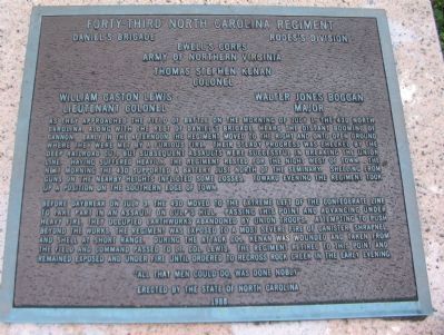
Forty-Third North Carolina Regiment
Daniel's Brigade - Rodes's Division
— Ewell's Corps —
Inscription.
Daniel's Brigade Rodes's Division
Ewell's Corps
Army of Northern Virginia
Thomas Stephen Kenan
Colonel
William Gaston Lewis
Lieutenant Colonel
Walter Jones Boggan
Major
As they approached the field of battle on the morning of July 1, the 43d North Carolina, along with the rest of Daniel's Brigade heard the distant booming of cannon. Early in the afternoon the regiment moved to the right and onto open ground where they were met by a furious fire. Their steady progress was checked by the deep railroad cut, but subsequent assaults were successful in breaking the Union line. Having suffered heavily, the Regiment rested for the night west of town. The next morning the 43d supported a battery just north of the Seminary. Shelling from the guns on the nearby heights inflicted some losses. Toward evening the Regiment took up a position on the Southern edge of town.
Before daybreak on July 3, the 43d moved to the extreme left of the Confederate line to take part in an assault on Culp's Hill. Passing this point and advancing under heavy fire, they occupied earthworks abandoned by Union troops. Attempting to push beyond the works, the regiment was exposed to a most severe fire of canister, shrapnel, and shell at short range. During the attack Col. Kenan was wounded and taken from the field and command passed to Lt. Col. Lewis. The Regiment retired to this point and remained exposed and under fire until ordered to recross Rock Creek in the early evening.
Erected by the State of North Carolina
1988
Erected 1988 by State of North Carolina.
Topics. This historical marker is listed in this topic list: War, US Civil. A significant historical date for this entry is July 1, 1905.
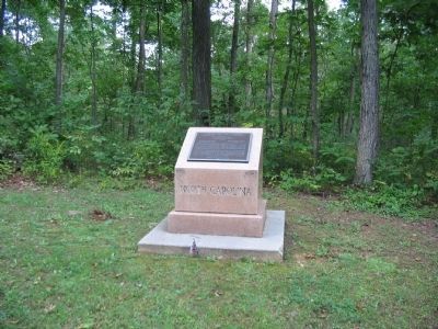
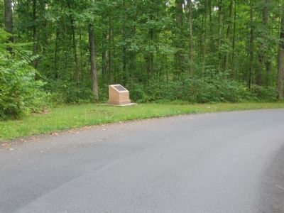
Location. 39° 49.114′ N, 77° 12.93′ W. Marker is near Gettysburg, Pennsylvania, in Adams County. It is in Cumberland Township. Marker is on East Confederate Avenue, on the left when traveling south. Located on the road up to Culp's Hill, Stop 13 on the driving tour of Gettysburg National Military Park. Touch for map. Marker is in this post office area: Gettysburg PA 17325, United States of America. Touch for directions.
Other nearby markers. At least 8 other markers are within walking distance of this marker. Daniel's Brigade (within shouting distance of this marker); Steuart's Brigade (about 500 feet away, measured in a direct line); O'Neal's Brigade (about 500 feet away); Johnson's Division (about 800 feet away); 28th Pennsylvania Infantry (approx. 0.2 miles away); A Useless Sacrifice of Life (approx. 0.2 miles away); Walker's Brigade
(approx. 0.2 miles away); 2nd Maryland Infantry (approx. 0.2 miles away). Touch for a list and map of all markers in Gettysburg.
Credits. This page was last revised on February 7, 2023. It was originally submitted on November 14, 2008, by Craig Swain of Leesburg, Virginia. This page has been viewed 1,029 times since then and 18 times this year. Photos: 1, 2, 3. submitted on November 14, 2008, by Craig Swain of Leesburg, Virginia.


