Centreville in Queen Anne's County, Maryland — The American Northeast (Mid-Atlantic)
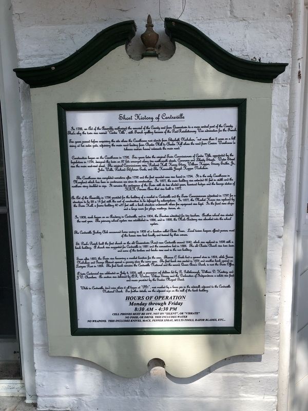
Short History of Centreville
Ten years passed before acquiring the the site where the Courthouse now stands from Elizabeth Nicholson, "not more than 2 acres on a hill rising at her outer gate, adjoining the main road leading from Chester Mill to Chester Hill where the road from Corsica Warehouse (a tobacco custom house) intersects the main road."
Construction began on the Courthouse in 1792. Two years later the original Town Commissioners of Centre Ville, appointed by the legislature in 1794, designed the town in 37 lots arranged along two north-south streets, Commerce and Liberty Streets. Water Street was the main east-west street. The original Commissioners were, Richard Hall, Henry Story, William Hopper, Emory Sudler, Jr., John Wells, Richard Tilghman Eads, and the Honorable Joseph Hopper Nicholson.
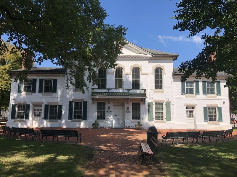
The courthouse was completed sometime after 1792 and the first recorded case was heard in 1794. It is the only Courthouse in Maryland which has been in continuous use since its construction. In 1877, the main building was extended 80 feet in width and the northern wing doubled in size. It remains the centerpiece of the Town with its tree shaded green, boxwood hedges and the bronze statue of HRH Princess Anne that was built in 1977.
An Act of Assembly in 1796 provided for the building of a market in Centreville and the Town Commissioners advertised in 1797 for a structure to be 28 × 14 feet with the cost of construction to by defrayed by subscriptions. In 1877, the Market House was replaced by the Town Hall, a frame building 40 × 70 feet with a brick structure underneath where fire equipment was kept. In the front were shops and a large room for plays, meetings, dances, etc. . .
In 1808, work began on an Academy in Centreville, and in 1804, the Trustees advertised for two teachers. Another school was started the next year. The primary school system was established in 1826, and in 1898, the Male Academy was absorbed into the school system.
The Centreville Jockey Club announced horse racing in 1805 at a location called Clover Green. Local town keepers offered guesses, most of the horses were bred locally and trained by their owners.
St. Paul's Parish built the first church on the old Queenstown Road near Centreville around 1640, which was replaced in 1698 with a brick building. A church was suggested for Centreville in 1881 and the cornerstone laid in 1884. The old Chester Church was torn down, and some of the
Soon after 1800, the Town was becoming a market location for the area. Thomas C. Earle had a general store in 1804, while James Nicholson and George Atwood opened a grocery store the same year. The first bank was erected in 1876 and another bank opened on Lawyers Row in 1884. The first bank remains the Centreville National and the second, Queen Anne's Bank, is now the Town Office.
A town Centennial was celebrated on July 4, 1876, with a procession of children led by R. Goldsborough, William D. Keating, and J.W. Chambers. An oration was delivered by P.R. Weedon; Wilmer Emory read the Declaration of Independence; a salute was fired and music provided by the Easton Mozart Band.
While in Centreville, don't miss where it all began at "PG1", now marked by a brass pin in the sidewalk adjacent to the Centreville National Bank. For further details, see the adjacent sign on the wall of the bank building.
Topics. This historical marker is listed in these topic lists: Colonial Era • Education • Entertainment • Settlements & Settlers. A significant historical date for this entry is July 4, 1876.
Location. 39° 2.707′ N, 76° 3.931′ W. Marker is in Centreville, Maryland, in Queen Anne's County. Marker is on Lawyers Row just east of Commerce Street (Maryland Route 213), on the left when traveling west. Touch for map. Marker is at or near this postal address: 100 Courthouse Square, Centreville MD 21617, United States of America. Touch for directions.
Other nearby markers. At least 8 other markers are within walking distance of this marker. The Queen Anne's County Courthouse (a few steps from this marker); Queen Anne’s County (a few steps from this marker); Honor • Valor • WWI • WWII • Korea • Vietnam (within shouting distance of this marker); a different marker also named Queen Anne's County Courthouse (within shouting distance of this marker); The Lions Club of Centreville POW - MIA Monument (within shouting distance of this marker); The Courthouse (within shouting distance of this marker); Centreville National Bank of Maryland (within shouting distance of this marker); The Brass Pin (within shouting distance of this marker). Touch for a list and map of all markers in Centreville.
Credits. This page was last revised on August 25, 2019. It was originally submitted on August 25, 2019, by Devry Becker Jones of Washington, District of Columbia. This page has been viewed 463 times since then and 55 times this year. Photos: 1, 2. submitted on August 25, 2019, by Devry Becker Jones of Washington, District of Columbia.

