Bedford Township in Bedford County, Pennsylvania — The American Northeast (Mid-Atlantic)
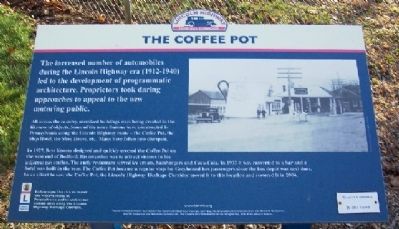
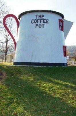
The Coffee Pot
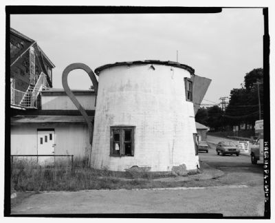
All across the country, oversized buildings were being created in the likeness of objects. Some of the more famous were constructed in Pennsylvania along the Lincoln Highway route - the Coffee Pot, the Ship Hotel, the Shoe House, etc. Many have fallen into disrepair.
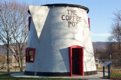
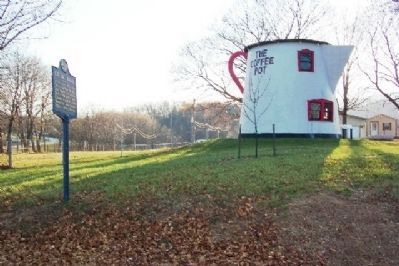
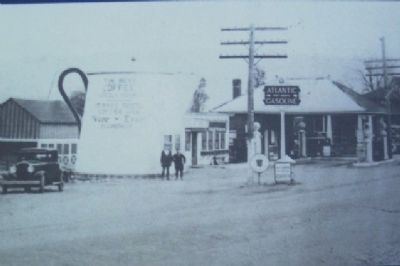
In 1927, Bert Koontz designed and quickly erected the Coffee Pot on the west end of Bedford. His intention was to attract visitors to his adjacent gas station. The early restaurant served ice cream, hamburgers and Coca-Cola. In 1937 it was converted to a bar and a hotel was built in the rear. The Coffee Pot became a regular stop for Greyhound bus passengers since the bus depot was next door. In an effort to save the Coffee Pot, the Lincoln Highway Heritage Corridor moved it to this location and restored it in 2004.
Erected by Lincoln Highway Heritage Corridor, the Department of Conservation and Natural Resources, the PA Historical and Museum Commission, the Community Foundation of the Alleghenies, and many private donors.
Topics and series. This historical marker is listed in these topic lists: Architecture • Industry & Commerce • Roads & Vehicles. In addition, it is included in the Lincoln Highway, and the Pennsylvania Historical and Museum Commission series lists. A significant historical year for this entry is 1927.
Location. 40° 1.375′ N, 78° 31.047′ W. Marker is near Bedford, Pennsylvania, in Bedford County. It is in Bedford Township. Marker is at the intersection of Pitt Street (Business U.S. 30) and Telegraph Road, on the left when traveling west on Pitt Street. Marker is next to The Coffee Pot, at the entrance to the Bedford Fairgrounds. Touch for map. Marker is in this post office area: Bedford PA 15522, United States of America. Touch for directions.
Other nearby markers. At least 8 other markers are within walking distance of this marker. Bedford Village (a few steps from this marker); NW Boundary Original Survey of Bedford (approx. 0.6 miles away); SW Boundary Original Survey of Bedford (approx. 0.7 miles away); Fort Bedford (approx. ¾ mile away); Grist Millstone (approx. ¾ mile away); Forbes Road (approx. ¾ mile away); This Tablet Marks The Site of Fort Bedford (approx. 0.8 miles away); "King's House" (approx. 0.8 miles away). Touch for a list and map of all markers in Bedford.
Also see . . . Lincoln Highway Heritage Corridor. (Submitted on December 1, 2008, by William Fischer, Jr. of Scranton, Pennsylvania.)
Credits. This page was last revised on February 7, 2023. It was originally submitted on December 1, 2008, by William Fischer, Jr. of Scranton, Pennsylvania. This page has been viewed 1,906 times since then and 62 times this year. Photos: 1, 2, 3, 4, 5. submitted on December 1, 2008, by William Fischer, Jr. of Scranton, Pennsylvania. 6. submitted on November 29, 2011, by Mike Wintermantel of Pittsburgh, Pennsylvania. • Bill Pfingsten was the editor who published this page.
