Watkinsville in Oconee County, Georgia — The American South (South Atlantic)
Eagle Tavern
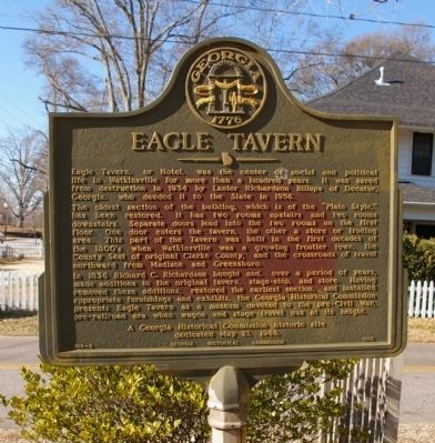
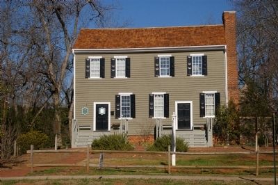
The oldest section of the building, which is of the “Plain Style,” has been restored. It has two rooms upstairs and two rooms downstairs. Separate doors lead into the two rooms on the first floor. One door enters the tavern, the other a store or trading area. This part of the Tavern was built in the first decades of the 1800's when Watkinsville was a growing frontier town, the County Seat of original Clarke County, and the crossroads of travel northward from Madison and Greensboro.
In 1836 Richard C. Richardson bought and, over a period of years, made additions to the original tavern, stage-stop, and store. Having removed these additions, restored the earliest section, and installed appropriate furnishings and exhibits, the Georgia Historical Commission presents Eagle Tavern as a museum devoted to the pre-Civil War, pre-railroad era when wagon and stage travel was at its height.
A Georgia Historical Commission historic site dedicated May 21, 1966.
Erected 1966 by Georgia Historical Commission. (Marker Number 108-5.)
Topics and series. This historical marker is listed in these topic lists: Industry & Commerce • Roads & Vehicles. In addition, it is included in the Georgia Historical Society series list. A significant historical date for this entry is May 21, 1968.
Location. 33° 51.834′ N, 83° 24.57′ W. Marker is in Watkinsville, Georgia, in Oconee County. Marker is at the intersection of North Main Street (Georgia Route 15) and Third Street North, on the right when traveling north on North Main Street. Touch for map. Marker is at or near this postal address: 26 North Main Street, Watkinsville GA 30677, United States of America. Touch for directions.
Other nearby markers. At least 8 other markers are within 3 miles of this marker, measured as the crow flies. Site of Frontier Blockhouse (a few steps from this marker); The Stoneman Raid (a few steps from this marker); Civilians Abducted During Stoneman’s Raid (a few steps from this marker); Oconee County (within shouting distance of this marker); In Honor of Our Revolutionary War Patriots (approx. ¼ mile away); Birthplace of Bishop A. G. Haygood and Miss Laura A. Haygood (approx. 0.4 miles away); E. D. Stroud School (approx. 1.1 miles away); Jeannette Rankin’s Georgia Home (approx. 2.2 miles away). Touch for a list and map of all markers in Watkinsville.
Credits. This page was last revised on February 1, 2020. It was originally submitted on December 3, 2008, by David Seibert of Sandy Springs, Georgia. This page has been viewed 1,185 times since then and 25 times this year. Photos: 1, 2. submitted on December 3, 2008, by David Seibert of Sandy Springs, Georgia. • Bill Pfingsten was the editor who published this page.

