Manalapan Township in Monmouth County, New Jersey — The American Northeast (Mid-Atlantic)
Battle at the Parsonage
The Battle of Monmouth
— 28 June 1778, 5:00 PM – 5:30 PM —
“General Wayne, occupying a barn and orchard in front, gave them a very warm reception.”
Dr. James McHenry, Secretary to George Washington.
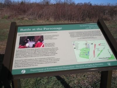
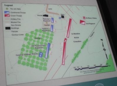
In the last action of the Battle, Brigadier-General Anthony Wayne led 400 Continentals across the bridge toward the withdrawing British Army. Seven hundred yards to your right, Wayne attacked the 1st Battalion of British Grenadiers. The Grenadiers rallied and began pushing back Wayne. As the Continentals neared the parsonage farm, Lord Stirling sent orders to Wayne to take cover here in the buildings and yards.
Protected by walls and fences, the Continentals of Malcolm’s, Spencer’s, and the 3rd Pennsylvania regiments held off the Grenadiers while Continental gunners pounded them from the north and south. Unable to use their bayonets, the Grenadiers retreated yet again. The Battle of Monmouth was over.
“I was at Monmouth Battle in a sharp encounter against the British grenadiers, … I commanded the platoon on the left of our party and being close pressed by the right of the enemy in front lost three of my men, …. Lord Stirling’s artillery played on the enemy so well that they ran back, and we immediately rallied and returned to our own ground where we remained under arms until next morning.”
1st Lieutenant Alexander Dow, Malcolm’s Additional Continental Regiment.
Erected by Department of Environmental Protection – Division of Parks & Forestry.
Topics. This historical marker is listed in these topic lists: Notable Events • Notable Places • War, US Revolutionary.
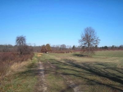
Location. 40° 16.115′ N, 74° 19.305′ W. Marker is in Manalapan Township, New Jersey, in Monmouth County. Marker can be reached from Freehold Road (County Route 522), on the right when traveling east. Marker is located on the Monmouth Battlefield hiking trail. Touch for map. Marker is in this post office area: Englishtown NJ 07726, United States of America. Touch for directions.
Other nearby markers. At least 8 other markers are within walking distance of this marker. Combs Hill Cannonade (approx. 0.3 miles away); Monmouth Battlefield State Park (approx. 0.3 miles away); Monmouth Battlefield (approx. 0.3 miles away); D’Annae: A French, Swedish-Style 4-pounder (approx. 0.4 miles away); Molly Pitcher (approx. 0.4 miles away); General von Steuben (approx. 0.4 miles away); Hold the Hedgerow! (approx. 0.4 miles away); a different marker also named Molly Pitcher (approx. half a mile away). Touch for a list and map of all markers in Manalapan Township.
More about this marker. The upper left of the marker contains a photograph of “Helms Company, 2nd NJ and Grenadier Company, Royal Welch Fusiliers at the Craig Farm, 1995.” The lower right of the marker features a battle map of the end of the Battle of Monmouth.
Also see . . .
1. The Battle of Monmouth. New Jersey during the Revolution. (Submitted on December 13, 2008, by Bill Coughlin of Woodland Park, New Jersey.)
2. The Battle of Monmouth, 1778. A British perspective of the Battle of Monmouth on BritishBattles.com. (Submitted on December 13, 2008, by Bill Coughlin of Woodland Park, New Jersey.)
Credits. This page was last revised on February 7, 2023. It was originally submitted on December 13, 2008, by Bill Coughlin of Woodland Park, New Jersey. This page has been viewed 1,454 times since then and 40 times this year. Photos: 1, 2, 3, 4, 5. submitted on December 13, 2008, by Bill Coughlin of Woodland Park, New Jersey.


