Greenville in Greenville County, South Carolina — The American South (South Atlantic)
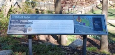
Old Mill Ruins
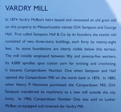
Vardry Mill
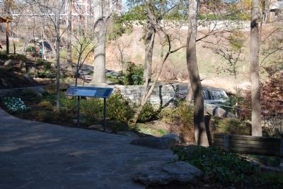
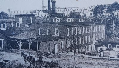
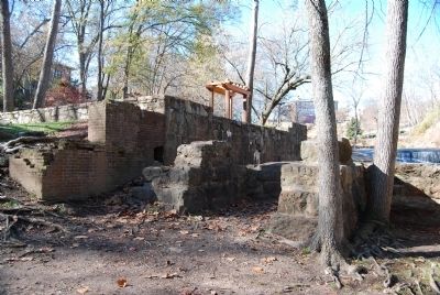
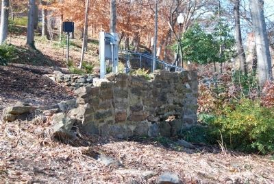
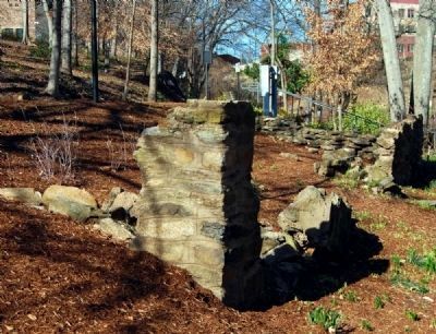
In 1874 Vardry McBee's heirs leased and renovated an old grain mill on this property to Massachusetts natives O.H. Sampson and George Hall. First called Sampson, Hall & Co. by its founders, the textile mill consisted of two, three-story buildings, each forty by twenty-eight feet. Its stone foundations are clearly visible below this terrace. The mill initially employed between fifty and seventy-five workers. Its 4,000 spindles spun cotton yarn for knitting and crocheting. It became Camperdown Number One when Sampson & Hall opened the Camperdown Mill on the north bank in 1876. In 1885, when Henry P. Hammett purchased the Camperdown Mill. O.H. Sampson transferred its machinery to a new mill outside the city limits. In 1906, Camperdown Number One was sold to Luther McBee, re-equipped and renamed the Vardry Mill.
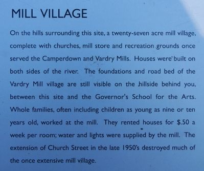
Mill Village
On the hills surrounding this site, a twenty-seven acre mill village, complete with churches, mill store and recreation grounds once served the Camperdown and Vardry Mills. Houses were built on both sides of the river. The foundations and road bed of the Vardry Mill village are still visible on the hill side behind you, between this site and the Governor's School for the Arts. Whole families, often including children as young as nine or ten years old, worked at the mill. They rented houses for $0.50 a week per room; water and lights supplied by the mill. The extension of Church Street in the late 1950's destroyed much of the once extensive mill village.
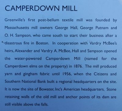
Camperdown Mill
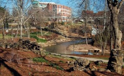
Greenville's first post-bellum textile mill was founded by Massachusetts mill owners George Hall, George Putnam and O.H. Sampson, who came south to start their business after a disastrous fire in Boston. In cooperation with Vardry McBee's heirs, Alexander and Vardry A. McBee, Hall and Sampson opened the water powered Camperdown Mill (named for the Camperdown elms on the property) in 1876. The mill produced yarn and gingham fabric until 1956, when the Citizens and Southern National Bank built a regional headquarters on the site. It is now the site of Bowater, Inc's American headquarters. Stone retaining walls of the old mill and anchor points of its dam are still visible above the falls.
Topics. This historical marker is listed in these topic lists: Industry & Commerce • Settlements & Settlers • Waterways & Vessels. A significant historical year for this entry is 1874.
Location. 34° 50.617′ N, 82° 24.017′ W. Marker is in Greenville, South Carolina, in Greenville County. Marker is on Furman College Way. Touch for map. Marker is in this post office area: Greenville SC 29605, United States of America. Touch for directions.
Other nearby markers. At least 10 other markers are within walking distance of this marker. Vardry Mill (a few steps from this marker); Reedy River Falls (a few steps from this marker); Mill Village (within shouting distance of this marker); Furman University (within shouting distance of this marker); River Lodge (within shouting distance of this marker); The Cherokees (within shouting distance of this marker); a different marker also named Furman University (within shouting distance of this marker); Liberty Bridge (about 300 feet away, measured in a direct line); a different marker also named Furman University (about 300 feet away); Falls Reclaimed and the Liberty Bridge 2004 (about 400 feet away). Touch for a list and map of all markers in Greenville.
Also see . . . Friends of the Reedy River. Organization website homepage (Submitted on December 20, 2021, by Larry Gertner of New York, New York.)
Additional commentary.
1. Reedy River Falls Historic Park and Greenway I
The proposed Reedy River Park in an 8.13 acre plot of land which is located at the heart of present day Greenville. The site includes the forty foot high Reedy River Falls and a secondary set of rapids in a rocky gorge downstream from these. The riverbank portion of the park includes the old Furman University botanical gardens and arboretum as well as the ruins of an early mill.
The 8.13 acre park includes six acres deeded to the City of Greenville by Furman University and some 2.13 acres of additional land. Most of this land lies below the Reedy River falls and provides an extremely desirable open space in this metropolitan area.
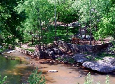
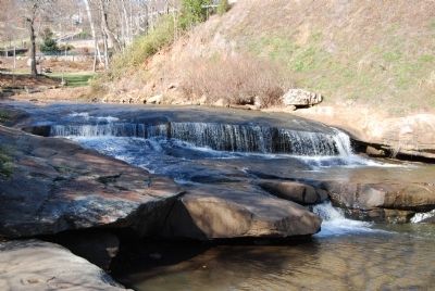
The Reedy River Falls lie just southeast of the South Main Street bridge and form the northernmost attraction of the park. At this point, the Reedy River plunges over a forty-foot drop into a rocky gorge which is defined on one side by the steep, rocky and heavily-wooded Camperdown Bluff. Within this area, a secondary set of falls can be found. These rapids were of key importance in the development of Greenville. Some brick ruins, presumed to be the remains of Vardry Mill built ca. 1830, are still visible on the riverbank at this point. The wide granite outcroppings below the main falls will be used for picnic facilities, walkways and footpaths. The low-lying land immediately west of this point was developed forty years ago as a botanical garden and arboretum by Furman University. The University which is no longer located in this area of Greenville has deeded these six acres of land to the city for the proposed park. Although some of the shrubs and trees of the early planting are still evident, the area has largely reverted to its natural state.
The City of Greenville has undertaken to maintain the immediate area. Overhead lighting and underground water connections are being installed. Projects are underway to clear the area of underbrush, excavate the sites of archeological importance and curtail riverbank erosion by the rapidly moving stream. Trails, walkways, footpath and picnic areas will complete the park's development.
Significance
The Reedy River Falls are not only the geographical but also the historical center of Greenville. The speed and power of the falls and the rapids below them were indirectly responsible for the founding of the city in 1812 when the city's first building, a grist mill, was built at this site. Since that time, the mills that were the economic life of the town sat near the falls and used their power to grind flour or manufacture textiles.
Industrial Significance
The land immediately surrounding the Reedy River Falls was deeded to one Richard Pearis just prior to the American Revolutionary War. Reaction by his neighbors to his Tory-Loyalist sympathies forced him to leave the area hurriedly. The only trace of his having been there at all is the fact that his name (despite a change in spelling) has been attached to nearby Paris Mountain. The following owner, Lemuel Alston, remained in control of the land until 1815. He was a representative in the South Carolina legislature in 1789 and was responsible for the establishment of a corn and grist mill at the head of Reedy River Falls in 1812. Traditionally, this has become the date of the founding of Pleasantburg. In 1815, the tract which had increased by then to 11,018 acres was sold to Vardry McBee. The remains of a granite and brick mill which he built on the lower falls in the l830s can still be discerned. The surrounding town of Pleasantburg continued to prosper with income derived from its thriving industry and in its 1831 charter the town changed its name to Greenville. The continuing growth of the town enticed further industry. The construction of the Camperdown Mills in 1870 was responsible for the decline of the falls and the eventual erosion of the banks below the mill outlets.
Rehabilitation of the area began with the opening of the Furman University botanical garden and arboretum in 1929-30. Since 1967, the Carolina Foothills Garden Club and the City of Greenville have been working to make the central part of this acreage suitable for a recreational park. (Source: Original National Register nomination form.)
— Submitted March 27, 2010, by Brian Scott of Anderson, South Carolina.
2. Reedy River Falls Historic Park and Greenway II
The Reedy River Park is a 14 acre property located at the heart of present day Greenville. The site includes the 50 foot Reedy River Falls and a secondary set of rapids in a rocky gorge downstream from these. The riverbank portion of the park includes the old Furman University botanical gardens and arboretum as well as the ruins of an early mill.
The park contains 6 acres deeded to the City of Greenville by Furman University and some 8 acres of additional land purchased by the City. Most of the property lies below the Reedy River Falls and provides an extremely desirable open space in this metropolitan area.
The Reedy River Falls lie just southeast of the South Main Street bridge and form the northernmost attraction of the park. At this point, the Reedy River plunges over a 50 foot drop into a rocky gorge which is defined on one side by the steep, rocky and heavily wooded Camperdown Bluff. Within this area a secondary set of falls can be found. These rapids were of key importance in the development of Greenville. Some brick ruins, presumed to be the remains of Vardry Mill built circa 1830, are still visible on the riverbank at this point. The wide granite outcroppings below the main falls are used for
picnic facilities, walkways and footpaths. The low lying land immediately west of this point was developed ca. 1930 as a botanical garden and arboretum by Furman University.
The City of Greenville and the Carolina Foothills Garden Club have undertaken the development and maintenance of the area. Overhead lighting and underground water connections have been installed. Trails, walkways, and picnic areas have been constructed along the riverbanks. A 2.2 mile bike path has been constructed, connecting Reedy River Park with Cleveland Park, another city park. (These additions have not destroyed the historical integrity of the site.) In addition, a 19th Century structure known as the Falls Cottage has been renovated. It is being used cooperatively by the Greenville Metropolitan Arts Council, the Carolina Foothills Garden Club, and the Greenville Artists Guild.
Because the original nomination did not clearly delineate the nominated property and because the property has undergone changes, the nomination has been revised to clearly define the boundaries and to reflect the enlarged acreage.
Significance
The Reedy River Falls are not only the geographical but also the historical center of Greenville. The speed and power of the falls and rapids below them were indirectly responsible for the founding of Greenville at this site in the early 1800's. Since that time, the mills that were the economic life of the city sat near the falls and used their power to grind flour and cornmeal or manufacture textiles. In the 1930's, the area surrounding the falls acquired additional significance as the site of a botanical garden and arboretum. Today, the falls are being preserved and the surrounding area developed as the Reedy River Falls Historic Park and Greenway.
Industry
The land immediately surrounding the Reedy River Falls was granted to Richard Pearis just prior to the American Revolution. The first white settler known in the area, Pearis established a grist mill and Indian trading post next to the falls. Reaction by his neighbors to his Tory-Loyalist sympathies forced him to leave the area hurriedly, his property later being confiscated by the State of South Carolina.
After changing hands several times, the property was deeded to Lemuel J. Alston in 1788. Alston remained in control of the land until 1815 when the tract which had increased to 11,018 acres was sold to Vardry McBee. The Town of Pleasantburg having been founded in 1812, McBee began development of the area with the construction of two mills, the remains of which can still be discerned. The surrounding Town of Pleasantburg continued to prosper with income derived from its thriving industry and in its 1831 charter, the town changed its name to Greenville. The continuing growth of the town enticed further industry. The construction of the Camperdown Mills about 1870 was responsible for the decline of the area surrounding the falls and the eventual erosion of the banks below the mill outlet. (These mills are no longer extant.)
Conservation
The rocky gorge and bluff site below old Camperdown Mills have profuse and distinctive natural foliage, helping to produce an area described in 1907 as "the most distinctive feature of the topography and landscape of the City of Greenville." Rehabilitation of the area began with the opening of the Furman University botanical garden and arboretum in 1929-30. Since 1967, the Carolina Foothills Garden Club and the City of Greenville have been working to develop the park. The gorge and falls site now serve as a focal point of the greenway and bike path which connect Reedy River Park and Cleveland Park, another municipal recreational facility. Preservation of this area is therefore not only of historical importance, but also provides a valuable recreational asset for downtown Greenville. (Source: Revised National Register nomination form.)
— Submitted March 27, 2010, by Brian Scott of Anderson, South Carolina.
Credits. This page was last revised on December 20, 2021. It was originally submitted on December 20, 2008, by Brian Scott of Anderson, South Carolina. This page has been viewed 2,491 times since then and 75 times this year. Photos: 1, 2, 3, 4, 5, 6. submitted on December 20, 2008, by Brian Scott of Anderson, South Carolina. 7. submitted on May 26, 2010, by Brian Scott of Anderson, South Carolina. 8, 9. submitted on December 20, 2008, by Brian Scott of Anderson, South Carolina. 10, 11. submitted on March 27, 2010, by Brian Scott of Anderson, South Carolina. 12. submitted on December 20, 2008, by Brian Scott of Anderson, South Carolina.
