Pickadat Corner in Chesterfield County, Virginia — The American South (Mid-Atlantic)
Battle of Swift Creek
"Brave to Madness"
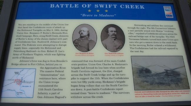
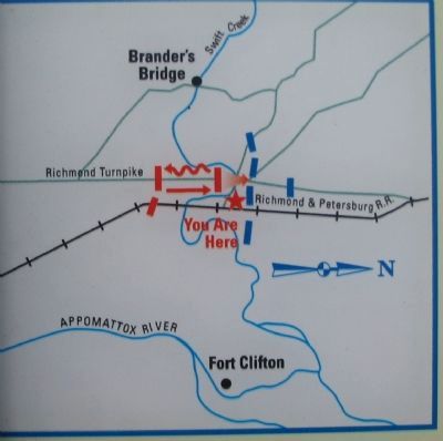
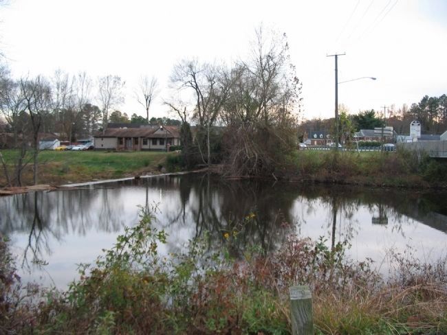
Johnson's force was dug in from Brander's Bridge almost to Fort Clifton, behind you on the Appomattox River. The massive Federal "demonstration" met resistance here, where the Union troops encountered the 11th South Carolina Infantry, a part of Gen. Johnson Hagood's command that was forward of the main Confederate position. Union Gen. Charles A. Heckman's brigade had formed its line here when another South Carolina regiment, the 21st, charged across the Swift Creek bridge and up the turnpike to support the 11th. When the Confederates were but fifty yards away, Heckman's brigade began firing volleys that cut the South Carolinians down. A post-battle Confederate report termed them "brave to madness." The survivors withdrew across the creek.
Skirmishing and artillery fire continued through the night. The 8th Connecticut Infantry, a unit partially armed with Sharps "revolving rifles," repulsed a Confederate advance across the railroad bridge east of the turnpike. The 63rd Tennessee Infantry turned back some Union gunners who got a cannon down to the creek bank. In the morning, Butler ordered a withdrawal. The Confederates had the railroad repaired by the next day.
Erected by Virginia Civil War Trails.
Topics and series. This historical marker is listed in this topic list: War, US Civil. In addition, it is included in the Virginia Civil War Trails series list. A significant historical month for this entry is May 1828.
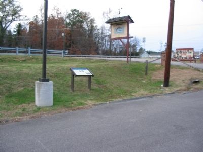
Location. 37° 17.02′ N, 77° 24.722′ W. Marker is in Pickadat Corner, Virginia, in Chesterfield County. Marker is on Jefferson Davis Highway (U.S. 1 / 301), on the right when traveling north. Located in the parking lot for the Swift Creek Mill. Touch for map. Marker is in this post office area: Colonial Heights VA 23834, United States of America. Touch for directions.
Other nearby markers. At least 8 other markers are within one mile of this marker, measured as the crow flies. "Brave to Madness" (about 400 feet away, measured in a direct line); Union Army Checked (approx. 0.2 miles away); Swift Creek Battlefield: A Landscape of Change (approx. ¼ mile away); Electric Railway (approx. 0.3 miles away); Redwater Creek Engagement (approx. 0.9 miles away); Union Army Railroad Raids (approx. 0.9 miles away); Advance on Petersburg (approx. one mile away); Ellerslie (approx. one mile away). Touch for a list and map of all markers in Pickadat Corner.
More about this marker. In the lower left of the marker is a map showing the tactical situation described in the text. In the upper center are portraits of Generals Benjamin F. Butler and Bushrod R. Johnson. In the lower right is a photograph showing railroad ties and rails stacked for demolition. Federals and Confederates alike disrupted the other side's rail communications by dismantling tracks and placing them across ties, which were then set afire to bend the tracks.
Additional commentary.
1.
Veterans of the S.C 25th Regiment of Hagood's Brigade, said in an obituary of Captain James M Carson, Commander Company A, that he "led the disastrous charge" at Swift Creek. In Gen. Hagood's "Memoirs of the War of Secession", pages 227-231, he says that Captain Carson commanded a detachment of the 25th Reigment that was with Gantt's 11th Regiment in this battle. He also says Captain Carson was wounded severely and out of action for the rest of the campaign. Hagood states there were "31 killed,82 wounded and 24 missing, making an aggregate of 137 men thrown away because too many generals, and too far away from the field of battle."P. 230. Probably meaning Pickett and Bragg. The 25th Regiment also was committed during the battle to provide cover for the withdrawal, p.230. But, this stopped General Butler's advance and ended that threat to Richmond and Petersburg. Butler became "bottled up" in the Bermuda One Hundred and the 25th Regiment, as a part of Hagood's Brigade, was later freed to race north to the Battle of Cold harbor to take up positions at the southern most part of Lee's line....in time to receive Grant's final attacks ordered there, see discussions around P. 255-260, Memoirs.
When I was a small boy, my grand father told me of being able to put his finger in a deep groove above the left ear of his father, Captain James M Carson, from a wound he received in Virginia.
Capt. Carson later commanded the 25th Regiment as it was ordered out of the defenses at Petersburg, and left o/a the 20th of December, by train to the west, and Lynchburg, then south and went on to join the fight underway as they arrived at Ft. Fisher, N.C. Accounts say it was so cold on departure from Petersburg, that one soldier froze to death in a rail car at night as they traveled, P. 315..
Ft. Fisher guarded Wilmington,
the last open port the South had. About 65 ships including five Ironclads surrounded Ft. Fisher off the coast in an arc and fired on the fort aiming in a coordinated way, from one parapet to the next gun parapet, in the second and successful attack there. There Captain Carson was wounded again, early in the day's hand to hand fighting This time in the left shoulder. Family lore is that his arm and life were saved by a Union Surgeon. He was sent by ship to Ft. Monroe as a P.W. And was afterwards transferred to a P.W. prison on an island in New York harbor. At the end of the war, he was sent by ship to Virginia and had to walk home to South Carolina.
My own father, James M Carson II, named for and grand son of Captain James M Carson mentioned above, commanded an Anti Aircraft Battery at Pearl Harbor, Dec. 7, 1941, and later served on Gen. MacArthur's staff in Tokyo after WWII. He was later first President of Richard Bland College at Petersburg, VA.
I am great grand son and a two tour Infantry veteran of the Vietnam War.
I have an original hard bound copy of the obituary of my great grand father, with various first hand witness statements of his and their service in the South Carolina 25th Regiment, (AKA, Washington Light Infantry, of Charleston, S.C.)
Col. James M Carson III
U.S.M.A, '64
Ashland, Va
July 13, 2013 Note To Editor only visible by Contributor and editor
— Submitted July 13, 2013, by James M Carson, Jr of Ashland, Virginia.
Credits. This page was last revised on May 12, 2021. It was originally submitted on December 23, 2008, by Craig Swain of Leesburg, Virginia. This page has been viewed 4,669 times since then and 189 times this year. Last updated on May 11, 2021, by Bradley Owen of Morgantown, West Virginia. Photos: 1, 2, 3, 4, 5. submitted on December 23, 2008, by Craig Swain of Leesburg, Virginia. • J. Makali Bruton was the editor who published this page.
