Cumberland Township near Round Top in Adams County, Pennsylvania — The American Northeast (Mid-Atlantic)
Historic Breastworks
July 2, 1863 - Second Day
"Rude shelters were thrown up of the loose rocks that covered the ground."
Col. Joshua L. Chamberlain, U.S.A.
Commander, 20th Maine Volunteers
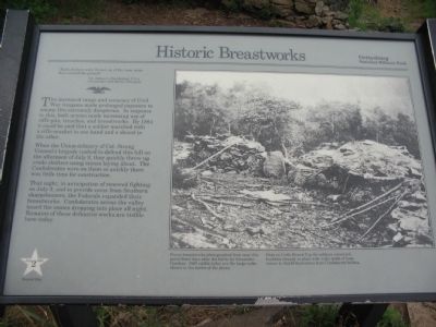
The increased range and accuracy of Civil War weapons made prolonged exposure to enemy fire extremely dangerous. In response to this, both armies made increasing use of rifle-pits, trenches, and breastworks. By 1864 it could be said that a soldier marched with a rifle-musket in one hand and a shovel in the other.
When the Union infantry of Col. Strong Vincent's brigade rushed to defend this hill on the afternoon of July 2, they quickly threw up crude shelters using stones laying about. The Confederates were on them so quickly there was little time for construction.
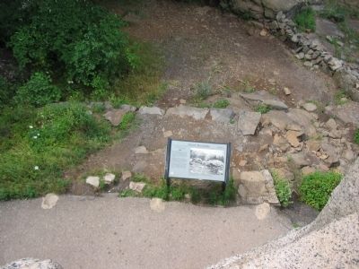
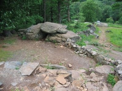
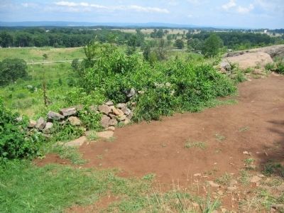
That night, in anticipation of renewed fighting on July 3, and to provide cover from Southern sharpshooters, the Federals expanded their breastworks. Confederates across the valley heard the stones dropping into place all night. Remains of these defensive works are visible here today.
Erected by Gettysburg National Military Park.
Topics. This historical marker is listed in this topic list: War, US Civil. A significant historical date for this entry is July 2, 1883.
Location. 39° 47.471′ N, 77° 14.224′ W. Marker is near Round Top, Pennsylvania , in Adams County. It is in Cumberland Township. Marker can be reached from Sykes Avenue, on the left when traveling north. Located at stop 8, Little Round Top, on the driving tour of Gettysburg National Military Park. Touch for map. Marker is in this post office area: Gettysburg PA 17325, United States of America. Touch for directions.
Other nearby markers. At least 8 other markers are within walking distance of this marker. 12th and 44th New York Infantry (a few steps from this marker); Col. Strong Vincent (a few steps from this marker); 140th New York Infantry (within shouting distance of this marker); Gen. Strong Vincent (within shouting distance of this marker); Defense of Little Round Top (within shouting distance of this marker); Sixteenth Michigan Infantry (within shouting distance of this marker); Third Brigade (within shouting distance of this marker); "Hold The Ground At All Hazards" (within shouting distance of this marker). Touch for a list and map of all markers in Round Top.
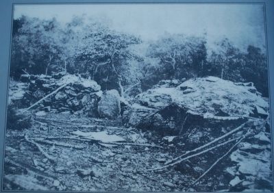
More about this marker. On the right side of the marker is a wartime photograph of the works. Union breastworks photographed from near this point three days after the battle by Alexander Gardner. Still visible today are the large rocks shown in the center of the photo.
Here on Little Round Top the soldiers connected boulders already in place with walls made of loose stones to shield themselves from Confederate bullets.
Credits. This page was last revised on February 7, 2023. It was originally submitted on January 1, 2009, by Craig Swain of Leesburg, Virginia. This page has been viewed 1,587 times since then and 23 times this year. Photos: 1. submitted on January 1, 2009, by Craig Swain of Leesburg, Virginia. 2. submitted on August 29, 2015, by Brandon Fletcher of Chattanooga, Tennessee. 3, 4, 5. submitted on January 1, 2009, by Craig Swain of Leesburg, Virginia.
