Near Petersburg in Dinwiddie County, Virginia — The American South (Mid-Atlantic)
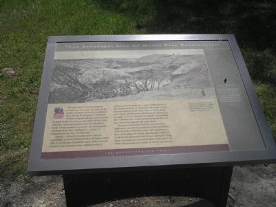
“The Strongest Line of Works Ever Constructed”
The Breakthrough Trail
— Pamplin Historical Park —
Inscription.
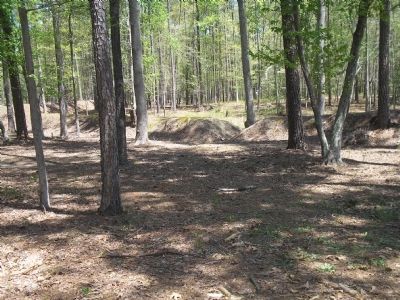
The main line of entrenchments behind you was only one part of the entire defensive network established here by the Confederates. Southern soldiers removed all the trees in front of their works to create a clear field of fire. They used the wood to improve their fortifications, build winter quarters, or as fuel for heating and cooking. They also established a variety of obstructions in front of their lines.
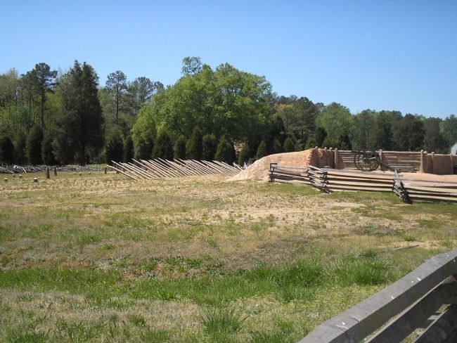
Abatis, a French military term, served essentially as the Civil War-version of barbed wire. The Confederates interlaced these solid rows of pointed tree branches and tangled brush at various intervals from their main fortifications to pin down attackers at optimum rifle range. Fraise, another French word, was a line of thick, sharpened limbs and branches buried in the ground at an angle to act as a barrier to assault. Occasionally the Confederates would string telegraph lines as trip wires throughout the open fields.
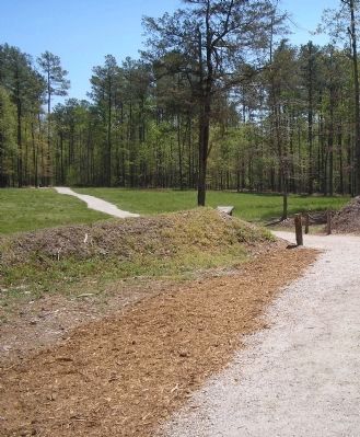
Pamplin Historical Park has removed the vegetation on selected portions of the battlefield to restore the landscape to its 1865 appearance, thus recreating the visual relationship between Confederate defenders and Union attackers. Today these clearings are discreet breaks in the forest. In 1865, this ground was nearly as barren as a desert.
Erected by Pamplin Historical Park.
Topics. This historical marker is listed in this topic list: War, US Civil. A significant historical year for this entry is 1865.
Location. 37° 10.785′ N, 77° 28.49′ W. Marker is near Petersburg, Virginia, in Dinwiddie County. Marker can be reached from Duncan Road (Virginia Route 670), on the left when traveling south. Marker is in Pamplin Historical Park, on the Breakthrough Trail. Touch for map. Marker is in this post office area: Petersburg VA 23803, United States of America. Touch for directions.
Other nearby markers. At least 8 other markers are within walking distance of this marker. McGowan’s South Carolina Brigade (within shouting distance of this marker); The Confederate Fortifications (within shouting distance of this marker); Petersburg Breakthrough Battlefield (within shouting distance of this marker); The Attack Begins (about 300 feet away, measured in a direct line); The Breakthrough Trail (about 300 feet away); Sergeant John E. Buffington (about 300 feet away); The Hart Farm (about 300 feet away); Lieutenant Colonel George B. Damon (about 400 feet away). Touch for a list and map of all markers in Petersburg.
More about this marker. The top of the marker contains a war-time photograph with the caption, “This view captures the outside of Union Fort Sedgwick, located about eight miles southeast of here. It shows abatis and fraise located
in front of the fort."
Also see . . . Breakthrough at Petersburg. The American Civil War website. (Submitted on January 17, 2009, by Bill Coughlin of Woodland Park, New Jersey.)
Credits. This page was last revised on February 2, 2023. It was originally submitted on January 17, 2009, by Bill Coughlin of Woodland Park, New Jersey. This page has been viewed 1,273 times since then and 24 times this year. Last updated on June 13, 2021, by Bradley Owen of Morgantown, West Virginia. Photos: 1, 2, 3, 4. submitted on January 17, 2009, by Bill Coughlin of Woodland Park, New Jersey. • Bill Pfingsten was the editor who published this page.


