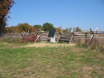
Cumberland Township near Gettysburg in Adams County, Pennsylvania — The American Northeast (Mid-Atlantic)
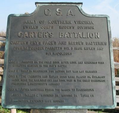
Carter's Battalion
Rodes's Division - Ewell's Corps
— Army of Northern Virginia —
Army of Northern Virginia
Ewell's Corps Rodes's Division
Carter's Battalion
Carter's, Fry's, Page's, and Reese's Batteries
Four 10 pounder Parrotts, Six 3 inch Rifles and
Six Napoleons
July 1 Arrived on the field soon after noon and rendered very effective service in the day's battle.
July 2 Held in readiness for action but was not engaged.
July 3 The Parrotts and Rifled guns were placed on Seminary Ridge near the railroad cut and took part in the great cannonade preceding Longstreet's assault.
July 4 After nightfall began the march to Hagerstown.
Losses. Killed 6 wounded 35 missing 24. Total 65.
Ammunition expended 1898 rounds.
Erected 1910 by Gettysburg National Military Park Commission.
Topics. This historical marker is listed in this topic list: War, US Civil. A significant historical year for this entry is 1898.
Location. 39° 50.873′ N, 77° 14.576′ W. Marker is near Gettysburg, Pennsylvania, in Adams County. It is in Cumberland Township. Marker can be reached from North Confederate Avenue, on the left when traveling south. Located on Oak Hill, near the Eternal Light Peace Memorial (Stop 2 of the driving tour) in Gettysburg National Military Park. Touch for map. Marker is in this post office area: Gettysburg PA 17325, United States of America. Touch for directions.
Other nearby markers. At least 8 other markers are within walking distance of this marker. Iverson's Brigade (a few steps from this marker); The Orange Artillery (within shouting distance of this marker); Rodes Attacks (within shouting distance of this marker); Rodes's Division (within shouting distance of this marker); A Dedication (within shouting distance of this marker); Eternal Light Peace Memorial (within shouting distance of this marker); a different marker also named Eternal Light Peace Memorial (about 300 feet away, measured in a direct line); The Morris Artillery (about 300 feet away). Touch for a list and map of all markers in Gettysburg.
Also see . . . Report of Lieut. Col. Thomas H. Carter. Col. Carter describes the actions of his guns succinctly in his official report:
The batteries fired with very decided effect, compelling the infantry to take shelter in the railroad cut, and causing them to change front on their right. The enemy's guns replied slowly. (Submitted on January 19, 2009, by Craig Swain of Leesburg, Virginia.)
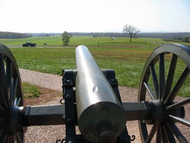
Photographed By Craig Swain, November 1, 2008
3. Carter's Guns Dominate Forney's Fields
Looking from the artillery displays just west of the Peace Light, to the south across the location of Forney's Farm. On the right is Buford Avenue, where the cavalry delayed the Confederates before the arrival of Rodes' Division. On the left are woods along Oak Ridge where the Federal infantry defended. Note in the center distance is the second railroad cut, and then beyond Reyonlds Avenue on McPherson's Ridge. Carter's Guns on Oak Hill enfiladed much of the Federal First Corps line.
The artillery piece here, a 12-pounder Confederate Napoleon, represents one of Carter's Guns.
The artillery piece here, a 12-pounder Confederate Napoleon, represents one of Carter's Guns.
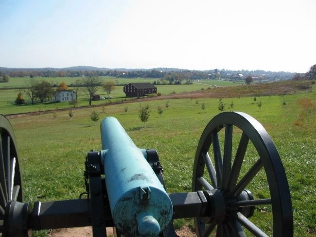
Photographed By Craig Swain, November 1, 2008
4. Another Gunner's View from Oak Hill
Looking over a Confederate 12-pounder Napoleon on Oak Hill toward Gettysburg. This was the view Carter's gunners had of the battlefield on July 1, particularly in the closing stages of the day's fighting. The McLean farm is in the center left. To the distant right is Gettysburg. On July 2, Carter's Battalion was arrayed in open fields north of Gettysburg between Mummasburg and Carlisle Roads. Roughly where the athletic fields are today.
Photographed By Craig Swain, November 1, 2008
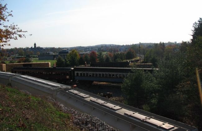
5. Carter's Battalion at the Railroad Cut
Looking from the third railroad cut toward the southeast over Gettysburg. While not the exact location of Carter's long range guns, this is the best approximation available today of their field of fire. The modern railroad junction does disrupt the foreground, but in the distance, landmarks in Gettysburg and Cemetery Hill beyond are visible.
Credits. This page was last revised on February 7, 2023. It was originally submitted on January 19, 2009, by Craig Swain of Leesburg, Virginia. This page has been viewed 1,151 times since then and 32 times this year. Photos: 1, 2, 3, 4, 5. submitted on January 19, 2009, by Craig Swain of Leesburg, Virginia.
