Sutherland in Dinwiddie County, Virginia — The American South (Mid-Atlantic)
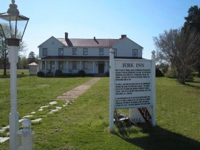
Fork Inn
Inscription.
Built in 1803 by Fendall Chiles Sutherland (1770-1833) and Elizabeth Traylor Sutherland (1785-1864), the Sutherland homestead also served as a stagecoach stop, inn, and tavern. The first post office in southside Virginia was established here in 1831.
On April 2, 1865 Fork Inn found itself on the Confederate defense line along the South Side Railroad. The ensuing battle left the house grounds occupied by Federal troops. Most of its contents were destroyed, and it was used briefly as a hospital.
It was purchased in 1873 by the William Meyers family who sold it to John B. Olgers in 1903. Mr. Olgers did extensive remodeling, portions of the original house and separate kitchen still exist. The house remains in the Olgers family.
Topics. This historical marker is listed in this topic list: War, US Civil. A significant historical date for this entry is April 2, 1865.
Location. 37° 11.793′ N, 77° 33.832′ W. Marker is in Sutherland, Virginia, in Dinwiddie County. Marker is at the intersection of Namozine Road (Virginia Route 708) and Cox Road (U.S. 460), on the left when traveling north on Namozine Road. Touch for map. Marker is in this post office area: Sutherland VA 23885, United States of America. Touch for directions.
Other nearby markers. At least 8 other markers are within 4 miles of this marker, measured as the crow flies. Engagement at Sutherland Station (within shouting distance of this marker); Sutherland Station (about 300 feet away, measured in a direct line); a different marker also named Sutherland Station (about 300 feet away); The Battle of Sutherland (about 400 feet away); Appomattox Campaign (Sutherland Station) (about 400 feet away); Rocky Branch School (approx. 0.7 miles away); Col. John Banister (approx. 1.2 miles away); The Battle of White Oak Road (approx. 3.2 miles away). Touch for a list and map of all markers in Sutherland.
Also see . . . The Battle of Sutherland’s Station. The American Civil War website. (Submitted on January 22, 2009, by Bill Coughlin of Woodland Park, New Jersey.)
Credits. This page was last revised on August 23, 2021. It was originally submitted on January 22, 2009, by Bill Coughlin of Woodland Park, New Jersey. This page has been viewed 1,307 times since then and 42 times this year. Photo 1. submitted on January 22, 2009, by Bill Coughlin of Woodland Park, New Jersey.
