Near Redcrest in Humboldt County, California — The American West (Pacific Coastal)
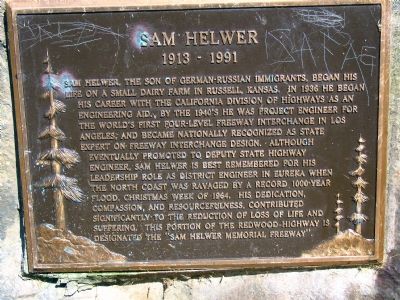
Sam Helwer
1913 – 1991
Topics. This historical marker is listed in this topic list: Roads & Vehicles. A significant historical year for this entry is 1936.
Location. 40° 26.809′ N, 124° 2.39′ W. Marker is near Redcrest, California, in Humboldt County. Marker can be reached from Sam Helwer Memorial Freeway (Highway 101), on the right when traveling south. Marker is at a highway vista point pull-out area. Touch for map. Marker is in this post office area: Redcrest CA 95569, United States of America. Touch for directions.
Other nearby markers. At least 5 other markers are within 5 miles of this marker, measured as the crow flies. Humboldt Redwoods State Park (approx. 0.6 miles away); The Pacific Lumber Company (approx. 4.2 miles away); Scotia Museum (approx. 4.2 miles away); Wi'ne'ma Theatre (approx. 4.2 miles away); Immortal Tree (approx. 4.3 miles away).
Also see . . . The Christmas flood of 1964 swept through 40 years ago by Jessie Wheeler. (Submitted on July 5, 2007, by Karen Key of Sacramento, California.)

By RubySS courtesy of Wikipedia Commons
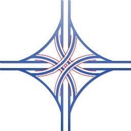
3. Four-Level Stack Interchange Diagram
Wikipedia: The four-level stack (or simply four-stack) has one major road crossing another on a bridge, with connector roads crossing on two further levels. Stacks eliminate the problems of weaving and have the highest vehicle capacity among different types of four-way interchanges. However, they require considerable and expensive construction work for their flyover ramps.
Click for more information.
Click for more information.

Wikoli courtesy of Wikipedia Commons
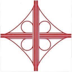
4. Cloverleaf Interchange Diagram
Wikipedia: Cloverleaf interchanges, viewed from overhead or on maps, resemble the leaves of a four-leaf clover. One problem with cloverleaf interchanges is the merging of exiting and entering traffic in the same lane. Another is the tight turns on inside ramps, which requires care for large trucks that risk turning over.
Click for more information.
Click for more information.

Photographed By US Geological Survey
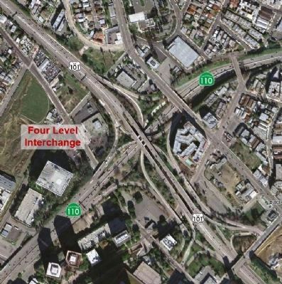
5. Sam Helwer’s Four-Level Interchange
This is the Bill Keene Memorial Interchange at the northern edge of Downtown Los Angeles, California, USA, it connects U.S. Route 101 (Hollywood Freeway and Santa Ana Freeway) to State Route 110 (Harbor Freeway and Arroyo Seco Parkway). Completed in 1949 and fully opened in 1953.
Click for more information.
Click for more information.
Credits. This page was last revised on November 5, 2019. It was originally submitted on July 5, 2007, by Karen Key of Sacramento, California. This page has been viewed 2,831 times since then and 63 times this year. It was the Marker of the Week September 22, 2013. Photos: 1, 2. submitted on July 5, 2007, by Karen Key of Sacramento, California. 3, 4, 5. submitted on September 21, 2013. • J. J. Prats was the editor who published this page.

