Near Providence Forge in New Kent County, Virginia — The American South (Mid-Atlantic)
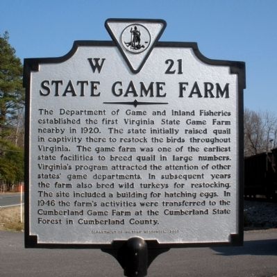
State Game Farm
Erected 2005 by Department of Historic Resources. (Marker Number W-21.)
Topics and series. This historical marker is listed in these topic lists: Agriculture • Animals. In addition, it is included in the Virginia Department of Historic Resources (DHR) series list. A significant historical year for this entry is 1920.
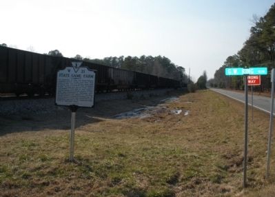
Location. 37° 25.849′ N, 76° 59.62′ W. Marker is near Providence Forge, Virginia, in New Kent County. Marker is at the intersection of Pocahontas Trail (U.S. 60) and GW King Boulevard, on the right when traveling east on Pocahontas Trail. Touch for map. Marker is in this post office area: Providence Forge VA 23140, United States of America. Touch for directions.
Other nearby markers. At least 8 other markers are within 4 miles of this marker, measured as the crow flies. Chickahominy Indians (approx. 1.4 miles away); Destruction of Chickahominy Indian Towns (approx. 1.4 miles away); Providence Forge (approx. 3 miles away); Forge Bridge (approx. 3 miles away); Chickahominy Water Trail (approx. 3˝ miles away); Blanks Crossroads (approx. 4.1 miles away); Piney Grove (approx. 4.1 miles away); Piney Grove and Southalls (approx. 4.1 miles away). Touch for a list and map of all markers in Providence Forge.
Credits. This page was last revised on June 16, 2016. It was originally submitted on March 7, 2009, by Bernard Fisher of Richmond, Virginia. This page has been viewed 1,262 times since then and 118 times this year. Photos: 1, 2. submitted on March 7, 2009, by Bernard Fisher of Richmond, Virginia.

