Near Charles City in Charles City County, Virginia — The American South (Mid-Atlantic)
Wilcox’s Landing
Crossing the James
— Lee vs. Grant – The 1864 Campaign —
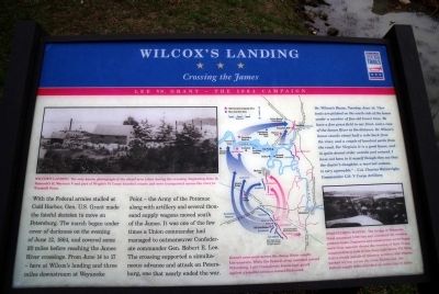
Dr. Wilcox’s House, Tuesday, June 14: “Our tents are pitched on the south side of the house under a number of fine old locust trees. We have a fine grass field in our front, and a view of the James River in the distance. Dr. Wilcox’s house stands about half a mile back from the river, and a couple of hundred yards from the road. For Virginia it is a good house, and in quite decent order outside and around. I have not been in it myself though they say that the doctor’s daughter, a married woman, is very agreeable.” – Col. Charles Wainwright, Commander U.S. V Corps Artillery
Erected by Virginia Civil War Trails.
Topics and series. This historical marker is listed in this topic list: War, US Civil. In addition, it is included in the Former U.S. Presidents: #18 Ulysses S. Grant, and the Virginia Civil War Trails series lists. A significant historical date for this entry is June 12, 1972.
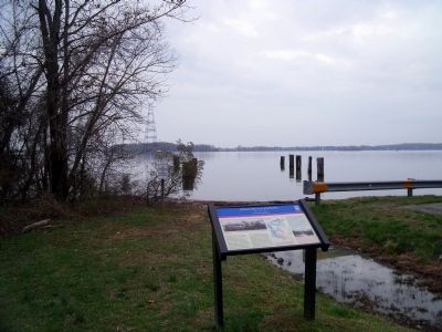
Location. 37° 19.035′ N, 77° 5.868′ W. Marker is near Charles City, Virginia, in Charles City County. Marker is on Wilcox Wharf Road, 0.2 miles south of Dalmation Drive, on the left when traveling south. Located in the parking lot of Lawrence Lewis Jr Park on the north bank of the James River. Touch for map. Marker is at or near this postal address: 12600 Wilcox Wharf Rd, Charles City VA 23030, United States of America. Touch for directions.
Other nearby markers. At least 8 other markers are within 3 miles of this marker, measured as the crow flies. John Smith Explores the Chesapeake (a few steps from this marker); Captain John Smith’s Trail on the James (approx. 0.2 miles away); a different marker also named Captain John Smith’s Trail on the James (approx. 0.2 miles away); Swineyards - Willcox Wharf (approx. 1.1 miles away); Grant's Crossing (approx. 1.1 miles away); John Tyler's Birthplace (approx. 1.8 miles away); Eye Witness to a Revolution (approx. 2.2 miles away); Shifting Ground (approx. 2.2 miles away). Touch for a list and map of all markers in Charles City.
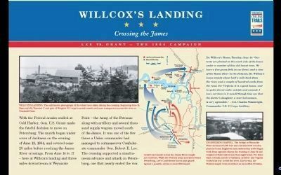
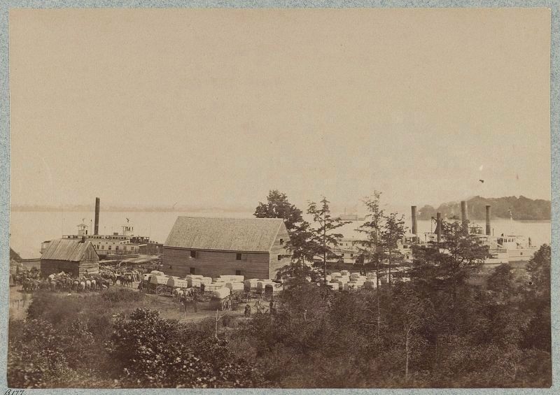
More about this marker. On the upper left is a photo of "Willcox’s Landing The only known photograph of the wharf area taken during the crossing. Beginning June14, Hancock’s II, Warren’s V and part of Wright’s VI Corps boarded vessels and were transported across the river to Windmill Point."
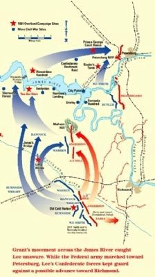
In the center is a map detailing Grant's march on Lee with the caption "Grant’s movement across the James River caught Lee unaware. While the Federal army marched toward Petersburg, Lee’s Confederate forces kept guard against a possible advance toward Richmond."
On the lower right is a photo with the caption, "Engineering Marvel The bridge at Weyanoke Point measured 2,100 feet and contained 101 wooden pontoon boats. Engineers and construction crews began work from opposite shores the evening of June 14 and completed their task in less than eight hours. For three days a steady parade of infantry, artillery and wagons worked its way across the river. End-to-end, the Federal supply train stretched an incredible 35 miles."
Also see . . . Civil War Traveler. Lee vs. Grant: The 1864 Overland Campaign Tour (Submitted on April 1, 2009, by Bernard Fisher of Richmond, Virginia.)
Credits. This page was last revised on December 25, 2021. It was originally submitted on March 31, 2009, by Bernard Fisher of Richmond, Virginia. This page has been viewed 3,690 times since then and 98 times this year. Photos: 1. submitted on March 31, 2009, by Bernard Fisher of Richmond, Virginia. 2, 3, 4. submitted on April 1, 2009, by Bernard Fisher of Richmond, Virginia. 5. submitted on May 8, 2009, by Bernard Fisher of Richmond, Virginia. 6. submitted on April 20, 2019, by Bernard Fisher of Richmond, Virginia.
