Cumberland in Allegany County, Maryland — The American Northeast (Mid-Atlantic)
French and Indian War
Fort Cumberland Trail
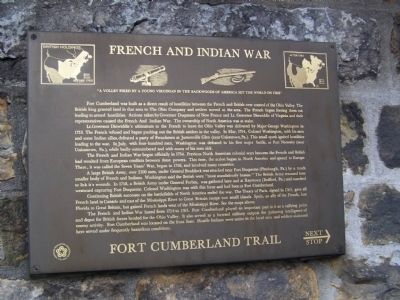
Fort Cumberland was built as a direct result of hostilities between the French and British over control of the Ohio Valley. The British king granted land in that area to The Ohio Company and settlers moved to the area. The French began forcing them out leading to armed hostilities. Actions taken by Governor Duquesne of New France and Lt. Governor Dinwiddie of Virginia and their representatives caused the French and Indian War. The ownership of North America was at stake.
Lt. Governor Dinwiddie's ultimatum to the French to leave the Ohio Valley was delivered by Major George Washington in 1753. The French refused and began pushing out the British settlers in the valley. In May, 1754, Colonel Washington, with his men and some Indian allies, defeated a party of Frenchmen at Jumonville Glen (near Uniontown, Pa.). This small spark ignited hostilities leading to the war. In July, with four-hundred men, Washington was defeated in his first major battle, at Fort Necessity (near Uniontown, Pa.), while badly outnumbered and with many of his men sick.
The French and Indian War began officially in 1754. Previous North American colonial wars between the French and British had resulted from European conflicts between these powers. This time, the action began in North America and spread to Europe. There, it was called the Seven Years' War, began in 1756, and involved many countries.
A large British Army, over 2100 men, under General Braddock was attacked near Fort Duquesne (Pittsburgh, Pa.), by a much smaller body of French and Indians. Washington said the British were "most scandalously beaten." The British army returned here to lick it's wounds. In 1758, a British Army under General Forbes, was gathered here and at Raystown (Bedford, Pa.) and marched westward capturing Fort Duquesne. Colonel Washington was with this force and had been at Fort Cumberland.
Continuing British successes on the battlefield of North America ended the war. The Treaty of Paris, signed in 1763, gave all French land in Canada and east of the Mississippi River to Great Britain except two small islands. Spain, an ally of the French, lost Florida to Great Britain, but gained French lands west of the Mississippi River. See the maps above.
The French and Indian War lasted from 1754 to 1763. Fort Cumberland played an important part in it as a rallying point and depot for British forces headed for the Ohio Valley. It also served as a forward military outpost for gathering intelligence of enemy activity. Fort Cumberland was located on the front lines. Hostile Indians were active in the local area and soldiers stationed here served under frequently hazardous conditions.
Fort Cumberland Trail
Topics. This historical marker is listed in these topic lists: Forts and Castles • War, French and Indian. A significant historical month for this entry is May 1754.
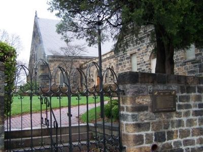
Location. 39° 39.016′ N, 78° 45.938′ W. Marker is in Cumberland, Maryland, in Allegany County. Marker can be reached from Prospect Square. Marker is in the alley between the church and the Masonic Building. Touch for map. Marker is in this post office area: Cumberland MD 21502, United States of America. Touch for directions.
Other nearby markers. At least 8 other markers are within walking distance of this marker. First Church of Christ, Scientist (Hoyt House) (within shouting distance of this marker); Emmanuel Episcopal Church (within shouting distance of this marker); Perimeter of the Fort (within shouting distance of this marker); Trenches and Tunnels / Army Discipline (within shouting distance of this marker); Abandonment of Ft. Cumberland (within shouting distance of this marker); The Old National Pike (within shouting distance of this marker); Beginning Of National Pike (within shouting distance of this marker); The Fort Bastions (within shouting distance of this marker). Touch for a list and map of all markers in Cumberland.
Credits. This page was last revised on February 28, 2020. It was originally submitted on April 5, 2009, by Bill Pfingsten of Bel Air, Maryland. This page has been viewed 3,099 times since then and 64 times this year. It was the Marker of the Week February 8, 2015. Photos: 1, 2. submitted on April 5, 2009, by Bill Pfingsten of Bel Air, Maryland.

