Lowell in Washington County, Ohio — The American Midwest (Great Lakes)
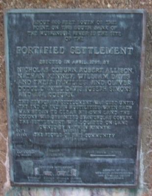
Fortified Settlement
Erected in April, 1799, by Nicholas Coburn, Robert Allison, Nathan Kinney, William Davis and their families, and Oliver Dodge, Daniel Davis, Joseph Simons and Asa Coburn.
This temporary settlement was used until the end of Indian hostilities when each man began to clear his own land. The colony was organized by Nicholas Coburn. The settlement was located on land owned by Nathan Kinney.
Erected by the people of this community April 7, 1938
Erected 1938 by The People of Lowell.
Topics. This historical marker is listed in these topic lists: Forts and Castles • Settlements & Settlers • Wars, US Indian. A significant historical month for this entry is April 1799.
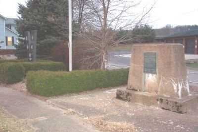
Location. 39° 31.659′ N, 81° 30.351′ W. Marker is in Lowell, Ohio, in Washington County. Marker is at the intersection of Main Street (Ohio Route 60) and Lock Street, on the right when traveling east on Main Street. Touch for map. Marker is in this post office area: Lowell OH 45744, United States of America. Touch for directions.
Other nearby markers. At least 8 other markers are within 7 miles of this marker, measured as the crow flies. Lowell Veterans Memorial (a few steps from this marker); Covered Bridges (about 400 feet away, measured in a direct line); The Devola Lock (approx. 4 miles away); Round Bottom Schoolhouse / Round Bottom Cemetery (approx. 4.7 miles away); Catherine Fay Ewing / Frances Dana Gage (approx. 6.4 miles away); Children’s Home (approx. 6.4 miles away); Sewah Studios (approx. 6.8 miles away); Fort Frye (approx. 6.8 miles away). Touch for a list and map of all markers in Lowell.
Credits. This page was last revised on June 16, 2016. It was originally submitted on April 17, 2009, by William Fischer, Jr. of Scranton, Pennsylvania. This page has been viewed 1,149 times since then and 15 times this year. Photos: 1, 2. submitted on April 17, 2009, by William Fischer, Jr. of Scranton, Pennsylvania. • Kevin W. was the editor who published this page.

