Downtown in Boston in Suffolk County, Massachusetts — The American Northeast (New England)
King’s Chapel Burial Ground
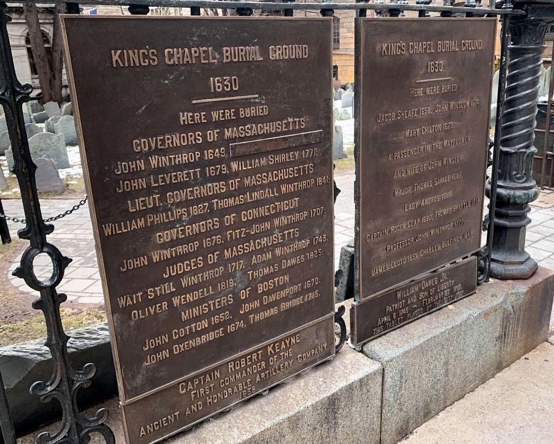
1630
Governors of Massachusetts
John Winthrop 1649, John Endicott 1665,
John Leverett 1679, William Shirley 1771,
Lieut. Governors of Massachusetts
William Phillips 1827, Thomas Lindall Winthrop 1841;
Governors of Connecticut
John Winthrop 1676, Fitz-John Winthrop 1707;
Judges of Massachusetts
Wait Still Winthrop 1717, Adam Winthrop 1743,
Oliver Wendell 1818, Thomas Dawes 1825;
Ministers of Boston
John Cotton 1652, John Davenport 1670,
John Oxenbridge 1674, Thomas Bridge 1715.
Captain Robert Keayne
First commander of the
Ancient and Honerable Artillery Company
1638
Here were buried
Jacob Sheafe 1658, John Winslow 1674.
Mary Chilton 1679,
A passenger in the Mayflower
and wife of John Winslow.
Lady Andros 1688,
Captain Roger Clap 1690, Thomas Brattle 1713,
Professor John Winthrop 1776.
James Lloyd 1831, Charles Bulfinch 1844.
William Dawes Jr.
Patriot and Son of Liberty
April 6 1745 – February 25 1799.
This tablet placed by the city 1901.
Erected 1901 by City of Boston.
Topics. This historical marker is listed in this topic list: Cemeteries & Burial Sites. A significant historical date for this entry is February 25, 1799.
Location. 42° 21.496′ N, 71° 3.605′ W. Marker is in Boston, Massachusetts, in Suffolk County. It is in Downtown. Marker is on Tremont Street, on the right when traveling north. Touch for map. Marker is at or near this postal address: 40 Tremont St, Boston MA 02108, United States of America. Touch for directions.
Other nearby markers. At least 8 other markers are within walking distance of this marker. Welcome to King’s Chapel Burying Ground (here, next to this marker); Life and Death in Colonial Boston (a few steps from this marker); The Chevalier de Saint Sauveur (a few steps from this marker); Pilgrims and Patriots (a few steps from this marker); William Dawes Jr. (a few steps from this marker); King's Chapel (within shouting distance of this marker); The First Governor (within shouting distance of this marker); Robert Keayne / Col. Nicholas Paige (within shouting distance of this marker). Touch for a list and map of all markers in Boston.
Related markers. Click here for a list of markers that are related to this marker. Take a tour of the markers found in King’s Chapel Burying Ground.
Also see . . . King's Chapel and Burying Ground. Details of the Freedom Trail from the City of Boston website. (Submitted on May 7, 2009, by Bill Coughlin of Woodland Park, New Jersey.)

Photographed By Bill Coughlin, April 14, 2009
4. Grave of William Dawes Jr.
William Dawes was the "other man" who rode along with Paul Revere on the night of April 18, 1775 to warn of the approaching British troops. Dawes took the longer overland route to Lexington, while Revere took the shorter route originating across the Charles River.

Photographed By Devry Becker Jones (CC0), November 13, 2021
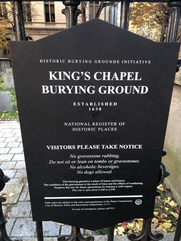
5. National Register of Historic Places sign hanging on the fence to the burying ground
Credits. This page was last revised on April 1, 2024. It was originally submitted on May 7, 2009, by Bill Coughlin of Woodland Park, New Jersey. This page has been viewed 2,409 times since then and 58 times this year. Photos: 1. submitted on March 30, 2024, by Marc Posner of Somerville, Massachusetts. 2, 3, 4. submitted on May 7, 2009, by Bill Coughlin of Woodland Park, New Jersey. 5. submitted on November 20, 2021, by Devry Becker Jones of Washington, District of Columbia.
Editor’s want-list for this marker. A wide shot of the marker in context. • Can you help?


