Gloucester Point in Gloucester County, Virginia — The American South (Mid-Atlantic)
Classic Camp Life
The Union Army Occupies Gloucester Point
“The name of our Fort is Fort Keyes, and it is strongly fortified. There is about 2000 men on this side of the [York] river and 2 batterys…” Private Stephen T. Buckson, 4th Delaware infantry Regiment, March 16, 1863, at Gloucester Point
The Union army fought its way up the York River, only to lose the hard fought Seven Days Battles around Richmond in June and July of 1862. The Union army left behind a large force that strengthened the defenses around Yorktown. That force would also occupy Gloucester Point for the rest of the Civil War.
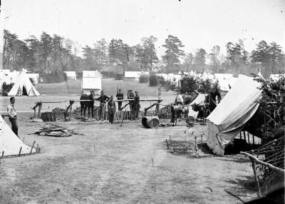
The garrison at Gloucester Point remained a sideshow to the great battles fought in the region. It was classic military camp life, months of monotonous routine punctuated by occasional attacks and forays into the countryside.
A Delaware Quaker, caught up in the emergency with millions of other Union volunteers, wrote a set of letters home about his life at Gloucester Point. Lieutenant Rodman Smith described his regiment’s camp. “On Gloucester Point proper is a large fort constructed by the rebels covering some 15 acres…to the rear of the fort where we are encamped is an extensive plain, a most magnificent drilling ground, as level as a pancake …the right section of the [picket] line rests on Sailor’s [Sarah’s] Creek, which…abounds in finest oysters and fish.”
(sidebar)
A New Type of Soldier
Delaware citizen soldier Rod Smith and his comrades brought a new dimension to warfare, the ability to read and write. Millions of letters from both sides of the conflict help make the Civil War a vivid memory. In a letter home, Smith thanked his family for a care package, and described the quality of the contents: "…canned peaches, tomatoes...are favorites…lemons, apples, oranges…are acceptable…and nothing so readily devoured [as] nuts."
Erected by Chesapeake Bay Gateways Network.
Topics. This historical marker is listed in this topic list: War, US Civil. A significant historical date for this entry is March 16, 1863.
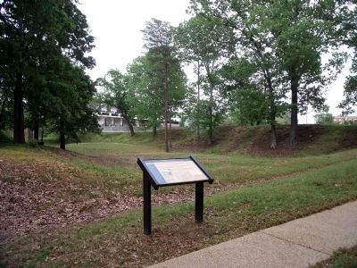
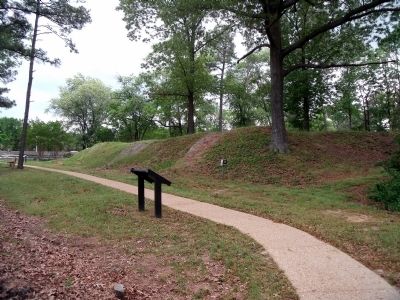
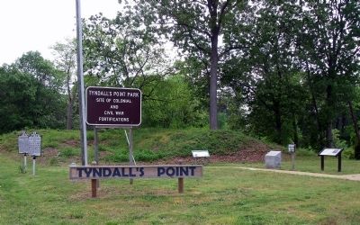
Location. 37° 14.979′ N, 76° 30.149′ W. Marker is in Gloucester Point, Virginia, in Gloucester County. Marker can be reached from Vernon Street near Riverview Street. The marker is on the Tyndall’s Point Park Walkway. Touch for map. Marker is at or near this postal address: 1376 Vernon Street, Gloucester Point VA 23062, United States of America. Touch for directions.
Other nearby markers. At least 8 other markers are within walking distance of this marker. Still Defending Virginia’s Shores (within shouting distance of this marker); Gloucester Point (within shouting distance of this marker); Attacking with “Decisive Vigor” (about 300 feet away, measured in a direct line); Where North Meets South
Photographed By Bernard Fisher, May 2, 2009
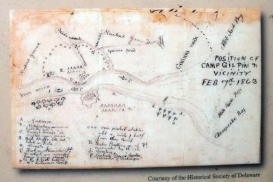
2. Position of Camp Gilpin & Vicinity, Feb 7, 1863.
Lt. Rodman Smith sent this hand-drawn map of Yorktown/Gloucester Point to his mother in Wilmington, Delaware. His regiment’s camp was marked with an E, then called Camp Gilpin. He was in command of pickets along Sailor’s [Sarah’s] Creek. Courtesy of the Historical Society of Delaware
More about this marker. On the upper left is a photo of a Union camp with the caption, “This Civil War camp, near Yorktown in 1862, is much like the camp of the 4th Delaware Regiment at Gloucester Point in 1863.” Courtesy of the Library of Congress
On the lower left is a photo of “Lieutenant (later Captain) S. Rodman Smith, Company I (and C), 4th Regiment, Delaware Infantry.” Courtesy of the Historical Society of Delaware
On the lower right is a map with the caption, “Lt. Rodman Smith sent this hand-drawn map of Yorktown/Gloucester Point to his mother in Wilmington, Delaware. His regiment’s camp was marked with an E, then called Camp Gilpin. He was in command of pickets along Sailor’s [Sarah’s] Creek.” Courtesy of the Historical Society of Delaware
Credits. This page was last revised on June 28, 2021. It was originally submitted on May 8, 2009, by Bernard Fisher of Richmond, Virginia. This page has been viewed 1,429 times since then and 61 times this year. Photos: 1, 2, 3, 4, 5, 6. submitted on May 8, 2009, by Bernard Fisher of Richmond, Virginia.

