Harpers Ferry in Jefferson County, West Virginia — The American South (Appalachia)
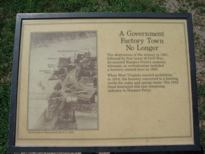
A Government Factory Town No Longer
When West Virginia enacted prohibition in 1914, the brewery converted to a bottling works for sodas and spring water. The 1942 flood destroyed this last remaining industry in Harpers Ferry.
Topics. This historical marker is listed in these topic lists: Industry & Commerce • War, US Civil. A significant historical year for this entry is 1861.
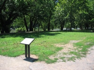
Location. 39° 19.322′ N, 77° 43.831′ W. Marker is in Harpers Ferry, West Virginia, in Jefferson County. Marker can be reached from Shenandoah Street (Business U.S. 340), on the right when traveling east. Located in lower town of Harpers Ferry National Historic Site, just south of the Winchester and Potomac Railroad. Touch for map. Marker is in this post office area: Harpers Ferry WV 25425, United States of America. Touch for directions.
Other nearby markers. At least 8 other markers are within walking distance of this marker. Market House (within shouting distance of this marker); Floods (within shouting distance of this marker); Casualties of Time (within shouting distance of this marker); Home of Samuel Annin (within shouting distance of this marker); Armory Workers (within shouting distance of this marker); Shenandoah Street about 1880 (within shouting distance of this marker); Armory Paymaster's Residence (within shouting distance of this marker); A Government Factory Town (about 300 feet away, measured in a direct line). Touch for a list and map of all markers in Harpers Ferry.
More about this marker. A photo on the left shows the North bank of Shenandoah River in 1896. To illustrate the effects of that year's flood, the boarding house ruins, brewery, market house, and paymasters house are indicated on the photograph.
Credits. This page was last revised on June 16, 2016. It was originally submitted on May 10, 2009, by Craig Swain of Leesburg, Virginia. This page has been viewed 1,065 times since then and 19 times this year. Photos: 1, 2. submitted on May 10, 2009, by Craig Swain of Leesburg, Virginia.

