Mount Pleasant in Charleston County, South Carolina — The American South (South Atlantic)
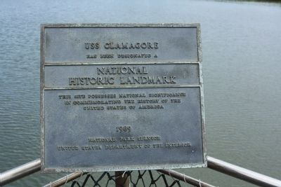
USS Clamagore
National
Historic Landmark
This Site Possesses National Significance
In Commemorating The History Of The
United States Of America
1989
National Park Service
United States Department Of The Interior
Erected 1989 by United States Department Of The Interior. (Marker Number #89001229.)
Topics and series. This historical marker is listed in these topic lists: Military • War, World II • Waterways & Vessels. In addition, it is included in the National Historic Landmarks series list. A significant historical year for this entry is 1989.
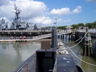
Location. Marker has been permanently removed. It was located near 32° 47.317′ N, 79° 54.511′ W. Marker was in Mount Pleasant, South Carolina, in Charleston County. On deck, at end of "forward" gang plank. Touch for map. Marker was at or near this postal address: 40 Patriot Point Road, Mount Pleasant SC 29464, United States of America.
We have been informed that this sign or monument is no longer there and will not be replaced. This page is an archival view of what was.
Other nearby markers. At least 8 other markers are within walking distance of this location. F-14A Tomcat (about 300 feet away, measured in a direct line); S-2 Tracker (about 400 feet away); U.S.S. Laffey (about 400 feet away); S-3B Viking (about 500 feet away); A-6E Intruder (about 500 feet away); Carrier-Based A-6 Intruder (about 500 feet away); F-8K Crusader (about 600 feet away); SH-3G Sea King (about 600 feet away). Touch for a list and map of all markers in Mount Pleasant.
Regarding USS Clamagore. Listed in the National Register June 29, 1989; Designated a National Historic Landmark June 29, 1989.
USS CLAMAGORE (SS-343) (added 1989 - - #89001229)
Also known as CLAMAGORE
Patriot's Point , Mt. Pleasant
♦ Historic Significance: Event, Architecture/Engineering
♦ Architect, builder, or engineer: Electric Boat Works
♦ Area of Significance: Military, Architecture
♦ Period of Significance: 1950-1974, 1925-1949
♦ Owner: Private
♦ Historic Function: Defense, Transportation
♦ Historic Sub-function: Naval Facility, Water-Related
♦ Current Function: Recreation And Culture
♦ Current Sub-function: Museum
Also see . . .
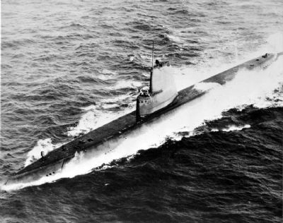
1. USS Clamagore (SS-343) , From Wikipedia. named for the clamagore or blue parrotfish (Scarus coeruleus) found in the West Indies and along the Atlantic coast as far north as Maryland. (Submitted on May 21, 2009, by Mike Stroud of Bluffton, South Carolina.)
2. National Historic Landmark Withdrawal of Designation Report.
Having been dismantled and recycled for scrap, the ex-USS Clamagore has ceased to meet the criteria for designation because the qualities which originally led it to be designated, have been destroyed or removed.(Submitted on April 30, 2024, by Pete Skillman of Townsend, Delaware.)
Additional commentary.
1. USS Clamagore Scrapped
This marker is no longer on the Clamagore because the vessel developed a leak and could not be repaired. It was towed away from Patriots Point and is being scrapped.
— Submitted April 30, 2024, by Pete Skillman of Townsend, Delaware.
Photographed By Mike Stroud, May 12, 2009
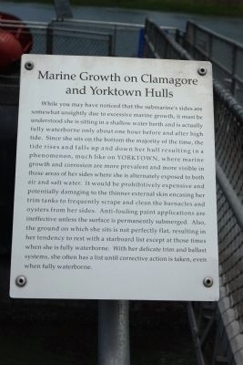
6. Marine Growth on Clamagore and Yorktown Hulls
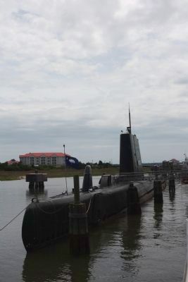
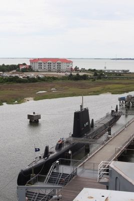
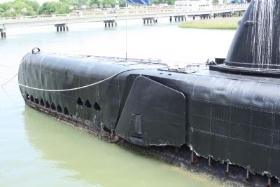
While you may have noticed that the submarine's sides are somewhat unsightly due to excessive marine growth, it must be understood she is sitting in a shallow water berth and is actually fully waterborne only about one hour before and after high tide. Since she sits on the bottom the majority of the time, the tide rises and falls up and down her hull resulting in a phenomenon, much like on YORKTOWN, where marine growth and corrosion are more prevalent and more visible in those areas of her sides where she is alternately exposed to both air and salt water. It would be prohibitively expensive and potentially damaging to the thinner external skin encasing her trim tanks to frequently scrape and clean the barnacles and oysters from her sides. Anti-fouling paint applications are ineffective unless the surface is permanently submerged. Also, the ground in which she sits is not perfectly flat, resulting in her tendency to rest with a starboard list except at those times when she is fully waterborne. With her delicate trim and ballast systems, she often has a list until corrective action taken, even when fully waterborne.
Credits. This page was last revised on April 30, 2024. It was originally submitted on May 20, 2009, by Mike Stroud of Bluffton, South Carolina. This page has been viewed 1,016 times since then and 32 times this year. Photos: 1, 2, 3, 4, 5, 6. submitted on May 21, 2009, by Mike Stroud of Bluffton, South Carolina. 7. submitted on September 30, 2013, by Mike Stroud of Bluffton, South Carolina. • Craig Swain was the editor who published this page.
