Near Pocahontas in Hardeman County, Tennessee — The American South (East South Central)
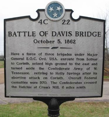
Battle of Davis Bridge
October 5, 1862
Erected by Tennessee Historical Commission. (Marker Number 4C 22.)
Topics and series. This historical marker is listed in this topic list: War, US Civil. In addition, it is included in the Tennessee Historical Commission series list.
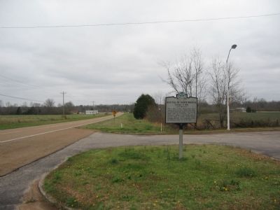
Location. 35° 2.865′ N, 88° 48.557′ W. Marker is near Pocahontas, Tennessee, in Hardeman County. Marker is on State Highway 57, on the right when traveling east. Touch for map. Marker is in this post office area: Pocahontas TN 38061, United States of America. Touch for directions.
Other nearby markers. At least 8 other markers are within 16 miles of this marker, measured as the crow flies. Engagement at Davis Bridge (approx. 1˝ miles away); a different marker also named Battle of Davis Bridge (approx. 1˝ miles away); Hell on the Hatchie (approx. 1.6 miles away); Battle of Tuscumbia (approx. 4.8 miles away); Battle Of Chewalla (approx. 9˝ miles away); Veteran's Plaza (approx. 11.2 miles away); The Trail of Tears (approx. 14.8 miles away); Kossuth (approx. 15.4 miles away in Mississippi). Touch for a list and map of all markers in Pocahontas.
Credits. This page was last revised on September 10, 2020. It was originally submitted on May 21, 2009, by Craig Swain of Leesburg, Virginia. This page has been viewed 3,560 times since then and 38 times this year. Photos: 1, 2. submitted on May 21, 2009, by Craig Swain of Leesburg, Virginia.

