Marker Logo HMdb.org THE HISTORICAL
MARKER DATABASE
“Bite-Size Bits of Local, National, and Global History”
Civic Center in Manhattan in New York County, New York — The American Northeast (Mid-Atlantic)
 

The Bridewell 1775-1838


The Bridewell 1775-1838 Marker image. Click for full size.
Photographed By Bill Coughlin, November 5, 2008
1. The Bridewell 1775-1838 Marker
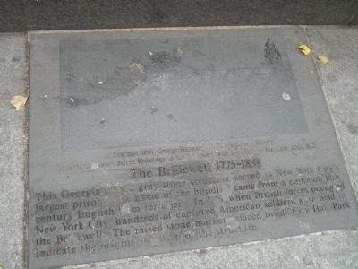
Inscription. This Georgian style gray stone structure served as New York City’s largest prison. The name of the building came from a common 18th century English term for a jail. In 1776, when British forces occupied New York City, hundreds of captured American soldiers were held in The Bridewell. The raised stone markers placed inside City Hall Park indicate the original location of the structure.
 
Topics. This historical marker is listed in these topic lists: Colonial EraWar, US Revolutionary. A significant historical year for this entry is 1776.
 
Location. 40° 42.741′ N, 74° 0.458′ W. Marker is in Manhattan, New York, in New York County. It is in Civic Center. Marker is on Broadway, on the left when traveling south. Marker is located on the sidewalk at the western edge of City Hall Park. Touch for map. Marker is in this post office area: New York NY 10279, United States of America. Touch for directions.
 
Other nearby markers. At least 8 other markers are within walking distance of this marker. July 10, 2015 (a few steps from this marker); February 7, 2012 (a few steps from this marker); British Soldiers' Barracks (a few steps from this marker); November 6, 2009 (a few steps from this marker); Liberty Poles (within shouting distance of this marker); Woolworth Building (within shouting distance of this marker); February 5, 2008
Paid Advertisement
Click on the ad for more information.
Please report objectionable advertising to the Editor.
Click or scan to see
this page online
(within shouting distance of this marker); The Freedom Tree (within shouting distance of this marker). Touch for a list and map of all markers in Manhattan.
 
More about this marker. A badly worn picture appears at the top of the marker. It has a caption of “Lithograph, 1860, George Hayward, D. T. Valentine's Manuals. Looking northeast across Broadway to the Bridewell, with City Hall to the right, circa 1820.”
 
Marker near City Hall Park image. Click for full size.
Photographed By Bill Coughlin, November 5, 2008
2. Marker near City Hall Park
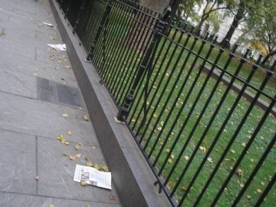
The stones that indicate the site of the prison can be seen in this photo in front of the marker.
The Bridewell image. Click for full size.
Photographed By Bill Coughlin, November 5, 2008
3. The Bridewell
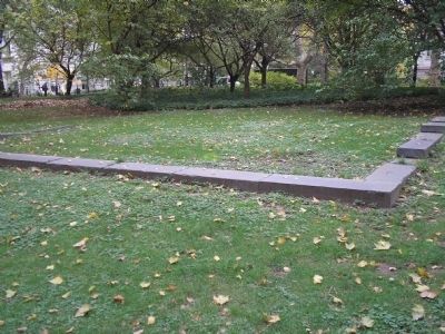
These stones, found in front of the marker in City Hall Park, mark original location of the Bridewell.
Site of the Bridewell image. Click for full size.
Photographed By Bill Coughlin, November 5, 2008
4. Site of the Bridewell
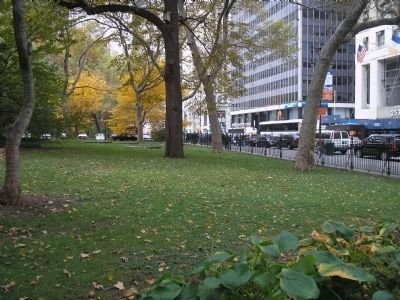
The stone markers of the former prison can be seen in this photo looking south in City Hall Park. Broadway can be seen on the right.
 
 
Credits. This page was last revised on January 31, 2023. It was originally submitted on June 5, 2009, by Bill Coughlin of Woodland Park, New Jersey. This page has been viewed 1,380 times since then and 110 times this year. Photos:   1, 2, 3, 4. submitted on June 5, 2009, by Bill Coughlin of Woodland Park, New Jersey.
Share this page.  
Share on Tumblr
m=19684

CeraNet Cloud Computing sponsors the Historical Marker Database.
This website earns income from purchases you make after using our links to Amazon.com. We appreciate your support.
Paid Advertisement
May. 9, 2024