Shakopee in Scott County, Minnesota — The American Midwest (Upper Plains)
Pond Mission
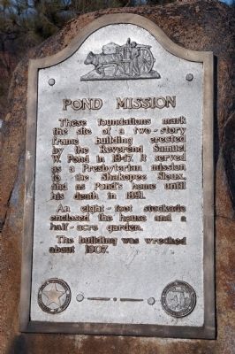
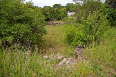
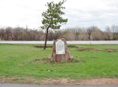
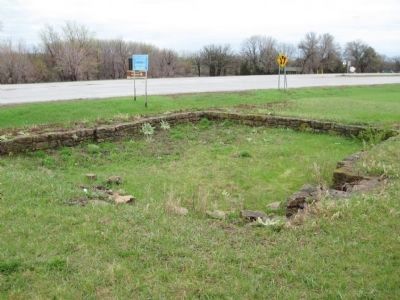
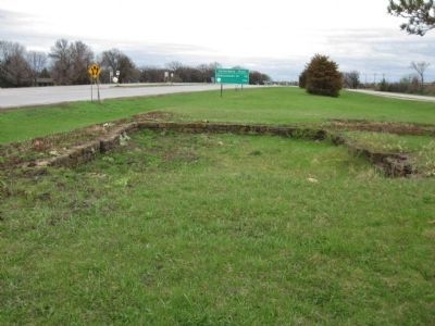
These foundations mark the site of a two-story frame building erected by the Reverend Samuel W. Pond in 1847. It served as a Presbyterian mission to the Shakopee Sioux, and as Pond's home until his death in 1891.
An eight-foot stockade enclosed the house and a half-acre garden.
The building was wrecked about 1907.
Erected 1954 by Minn Dept of Highways (MHD). (Marker Number SC-SPC-069.)
Topics and series. This historical marker is listed in these topic lists: Charity & Public Work • Churches & Religion • Native Americans • Settlements & Settlers. In addition, it is included in the Minnesota Historical Society series list. A significant historical year for this entry is 1847.
Location. 44° 48.067′ N, 93° 30.25′ W. Marker is in Shakopee, Minnesota, in Scott County. Marker is on County Route 101, 0.2 miles east of County Route 17, on the right when traveling east. The Mill Pond Roadside Parking Area is a small, 0.1-acre site within the city limits of Shakopee. Touch for map. Marker is in this post office area: Shakopee MN 55379, United States of America. Touch for directions.
Other nearby markers. At least 8 other markers are within walking distance of this marker. The Railroad to Shakopee 1865 (within shouting distance of this marker); The Ox Cart Trail to Shakopee (within shouting distance of this marker); Who Else Was Here (within shouting distance of this marker); The Springs (within shouting distance of this marker); Stagecoaches to Shakopee (within shouting distance of this marker); Betting, Booze & Speakeasies • 1920-1940 (within shouting distance of this marker); On The River Bottoms (within shouting distance of this marker); Rollin' Down the River 1842 (within shouting distance of this marker). Touch for a list and map of all markers in Shakopee.
More about this marker. The site is accessed via Cavanaugh Drive, an east-west asphalt paved city street that runs parallel to Highway 101 (there is no longer access directly from 101.)
A sign for the marker in Shakopee will send you to the wrong side of the highway. Follow 101 east out of Shakopee, turn right on Viking Steel Drive, and take another quick right onto Cavanaugh Drive.
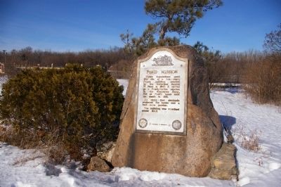
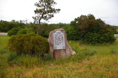
The site includes the foundation of the Pond Mission House which was built in 1847 by Rev. Samuel W. Pond and a marker about the mission mounted on a large boulder. The approximately 6' high boulder is mounted on end in a horseshoe-shaped, tan, limestone rubble base that measures about 4' by 5'. There is an aluminum plaque (rectangular with a curvilinear top) mounted on the southern side of the boulder (facing away from Highway 101). The seals of the Minnesota Historical Society and the Minnesota Department of Highways are cast at the bottom of the plaque. The text addresses the Pond Mission.
The site was originally an extensive roadside parking area built by the NYA (National Youth Administration) in 1941 that stretched for over 600' on both sides of Highway 101. Visitors could cross back and forth via a culvert that went under the highway. There were trails, picnic areas, a mill pond, and parking areas. The boulder marker was originally placed north of the mission foundation and faced Highway 101 to the north. It stood just east of an asphalt-paved entrance drive that led from Highway 101 south to a small rectangular parking area west of the foundation that was lined with timber posts. A timber hanging-arm sign of the type commonly used by the Highway Department's Roadside Development Division stood just east of the entrance drive. The sign read "Mill Pond Roadside Parking Area."
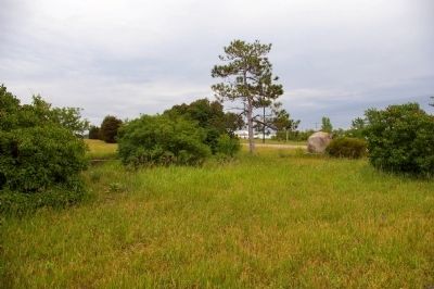
All that remains of the site are the mission foundation and the marker. The northern part of the site is gone. The stone-veneered concrete culvert has been replaced by a modern highway bridge. The southern parking area, picnic area, trails, and plantings have been removed. The entrance drive, parking area, and sign constructed circa 1954 were removed at an unknown date. The boulder marker was subsequently moved to the southern side of the Mission foundation and turned to face south.
Regarding Pond Mission. Samuel Pond and his brother Gideon (who "set up shop" across the Minnesota river in Bloomington, Minnesota) were laymen from Connecticut who had been converted in a New England revival and came to Minnesota in 1834 seeking a field for missionary work among the Sioux or Dakota Indians of the Northwest. Among many other accomplishments, the Pond brothers were important for being recorders of both the Dakota language and Sioux life and customs.
Related marker. Click here for another marker that is related to this marker. Samuel W. and Gideon H. Pond
Also see . . .
1. Pond Mission Site. (PDF) Minnesota Department of of Transportation. (Submitted on June 13, 2009, by Martha Decker of Shakopee, Minnesota.)
2. The Pond Brothers. Pond Dakota heritage Society website entry (Submitted on July 26, 2023, by Larry Gertner of New York, New York.)
Additional keywords. Dakota Indians
Photographed By Martha Decker, June 9, 2009
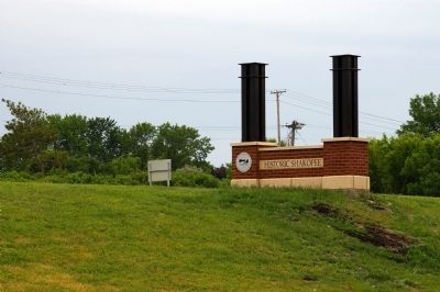
6. Pond Mission Site from Across the Highway
Ironic that this brand new "Historic Shakopee" sign is situated right across the highway from the overgrown and neglected Pond Mission marker. It also sits right on the site where they obliterated the entire north side of the old NYA-built roadside parking area.
Credits. This page was last revised on July 26, 2023. It was originally submitted on June 9, 2009, by Martha Decker of Shakopee, Minnesota. This page has been viewed 2,239 times since then and 83 times this year. Photos: 1, 2. submitted on June 9, 2009, by Martha Decker of Shakopee, Minnesota. 3, 4, 5, 6. submitted on June 10, 2009, by Martha Decker of Shakopee, Minnesota. 7. submitted on May 5, 2011, by Keith L of Wisconsin Rapids, Wisconsin. 8, 9. submitted on May 6, 2011, by Keith L of Wisconsin Rapids, Wisconsin. • Craig Swain was the editor who published this page.
