Seymour in New Haven County, Connecticut — The American Northeast (New England)
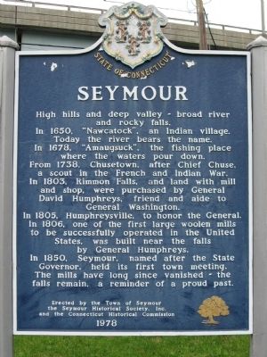
Seymour
In 1650 “Nawcatock”, an Indian village. Today the river bears the name.
In 1678, “Amaugsuck”, the fishing place where the waters pour down.
From 1738, Chusetown, after Chief Chuse, a scout in the French and Indian War.
In 1803, Rimmon Falls, and land with mill and shop, were purchased by General David Humphreys, friend and aide to General Washington.
In 1805, Humphreysville, to honor the General.
In 1806, one of the first large woolen mills to be successfully operated in the United States was built near the falls by General Humphreys.
In 1850, Seymour, named after the State Governor, held its first town meeting.
The mills have long since vanished – the falls remain, a reminder of a proud past.
Erected 1978 by the Town of Seymour, the Seymour Historical Society, Inc., and the Connecticut Historical Commission.
Topics and series. This historical marker is listed in these topic lists: Colonial Era • Settlements & Settlers. In addition, it is included in the Former U.S. Presidents: #01 George Washington series list. A significant historical year for this entry is 1650.
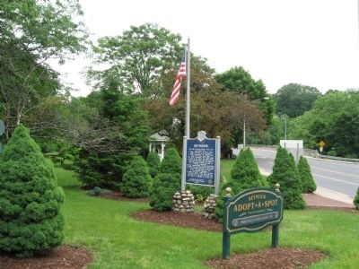
Location. 41° 23.531′ N, 73° 4.559′ W. Marker is in Seymour, Connecticut, in New Haven County. Marker is at the intersection of Derby Avenue and Broad Street (Connecticut Route 313), on the right on Derby Avenue. Located in Broad Street Park. Touch for map. Marker is in this post office area: Seymour CT 06483, United States of America. Touch for directions.
Other nearby markers. At least 8 other markers are within walking distance of this marker. Seymour Veterans Monument (a few steps from this marker); The Falls (about 500 feet away, measured in a direct line); Seymour School Bell (approx. 0.2 miles away); Seymour Soldiers Monument (approx. 0.6 miles away); Seymour World War I – World War II Memorial (approx. 0.6 miles away); Seymour Korean War Memorial (approx. 0.6 miles away); Seymour Vietnam War Memorial (approx. 0.6 miles away); Seymour Revolutionary War Memorial (approx. 0.6 miles away). Touch for a list and map of all markers in Seymour.
Credits. This page was last revised on June 16, 2016. It was originally submitted on June 15, 2009, by Michael Herrick of Southbury, Connecticut. This page has been viewed 1,378 times since then and 29 times this year. Photos: 1, 2. submitted on June 15, 2009, by Michael Herrick of Southbury, Connecticut. • Kevin W. was the editor who published this page.

