Near Warfield in Brunswick County, Virginia — The American South (Mid-Atlantic)
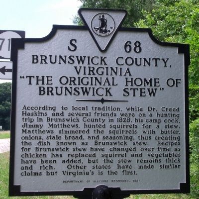
Brunswick County, Virginia
"The Original Home of Brunswick Stew"
Erected 1997 by Department of Historic Resources. (Marker Number S-68.)
Topics and series. This historical marker is listed in this topic list: Agriculture. In addition, it is included in the Virginia Department of Historic Resources (DHR) series list. A significant historical year for this entry is 1828.
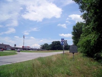
Location. 36° 56.577′ N, 77° 44.12′ W. Marker is near Warfield, Virginia, in Brunswick County. Marker is at the intersection of Boydton Plank Road (U.S. 1) and Old Stage Road, on the right when traveling south on Boydton Plank Road. Touch for map. Marker is in this post office area: Warfield VA 23889, United States of America. Touch for directions.
Other nearby markers. At least 8 other markers are within 7 miles of this marker, measured as the crow flies. Dinwiddie County / Brunswick County (within shouting distance of this marker); Birch's Bridge (within shouting distance of this marker); Origins of 4-H in Virginia (approx. 4 miles away); Birthplace of Roger Atkinson Pryor (approx. 4 miles away); Sapony Episcopal Church (approx. 5 miles away); Ebenezer Academy (approx. 5.7 miles away); Elizabeth Hobbs Keckley (1818-1907) (approx. 5.9 miles away); Sturgeon Creek (approx. 6.7 miles away). Touch for a list and map of all markers in Warfield.
Related markers. Click here for a list of markers that are related to this marker. Five state markers have this same title and text.
Credits. This page was last revised on August 30, 2017. It was originally submitted on June 22, 2009, by Bernard Fisher of Richmond, Virginia. This page has been viewed 921 times since then and 13 times this year. Photos: 1, 2. submitted on June 22, 2009, by Bernard Fisher of Richmond, Virginia.

