Near Randolph in Halifax County, Virginia — The American South (Mid-Atlantic)
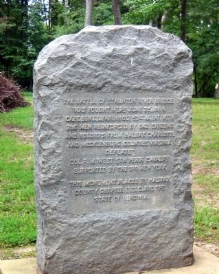
The Battle of Staunton River Bridge
was fought here June 25, 1864
Capt. Benj. L. Farinholt 53rd Va. Inf. with
296 men reinforced by 642 citizens
and soldiers from Halifax Charlotte
and Mecklenburg counties Virginia
Defeated
Col. R.M. West 5th Penn. Cavalry
Supported by the 3rd New York
This monument placed by Halifax
County Chapter U.D.C. and the
State of Virginia
Erected by Halifax County Chapter U.D.C.
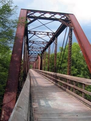
Topics and series. This historical marker is listed in these topic lists: Bridges & Viaducts • Forts and Castles • Railroads & Streetcars • War, US Civil. In addition, it is included in the United Daughters of the Confederacy series list. A significant historical month for this entry is June 1921.
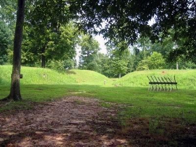
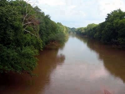
Location. 36° 52.922′ N, 78° 42.11′ W. Marker is near Randolph, Virginia, in Halifax County. Marker can be reached from Black Walnut Road (County Route 600) half a mile north of Fort Hill Trail. This marker is located in the Staunton River Battlefield State Park. Touch for map. Marker is in this post office area: Randolph VA 23962, United States of America. Touch for directions.
Other nearby markers. At least 8 other markers are within 7 miles of this marker, measured as the crow flies. Wilson’s orders were to destroy the Richmond and Danville Railroad to the greatest extent possible (approx. 0.8 miles away); Roanoke Station (approx. 0.8 miles away); Wilson-Kautz Raid (approx. 0.8 miles away); Carrington's Mill (approx. 3.9 miles away); Henrietta Lacks (approx. 4.9 miles away); The War of 1812 / War of 1812 Opposition — John Randolph (approx. 6.1 miles away); Wylliesburgh (approx. 6.3 miles away); Paul Carrington (approx. 6.4 miles away). Touch for a list and map of all markers in Randolph.
Also see . . .
1. Wilson–Kautz Raid. Wikipedia entry (Submitted on March 31, 2022, by Larry Gertner of New York, New York.)
2. Battle of Staunton River Bridge. Wikipedia entry (Submitted on March 31, 2022, by Larry Gertner of New York, New York.)
3. Staunton River Battlefield State Park. Virginia Department of Conservation & Recreation website entry (Submitted on June 25, 2009, by Bernard Fisher of Richmond, Virginia.)
4. Staunton River Battlefield State Park. Historic Staunton River Foundation (Submitted on June 25, 2009, by Bernard Fisher of Richmond, Virginia.)
Additional keywords. Wilson-Kautz
Raid

Photographed By Bernard Fisher, August 22, 2004
7. Union right flank west of the railroad. The tree line on the left fronts the river.
Col. Samuel R Spear's 1st D.C. and 11th Pa. approached along the east side of the railroad and Col. Robert M. West's 5th Pa. and 3rd N.Y. along the west side.
"I formed an assaulting party and directed it up the embankment, in the hope that by a quick move we might obtain possession of the main bridge sufficiently long enough to fire it. The men tried repeatedly to gain a foothold on the railroad, and to advance along the sides of the embankment, but could not." - Colonel Robert M. West
"I formed an assaulting party and directed it up the embankment, in the hope that by a quick move we might obtain possession of the main bridge sufficiently long enough to fire it. The men tried repeatedly to gain a foothold on the railroad, and to advance along the sides of the embankment, but could not." - Colonel Robert M. West
Credits. This page was last revised on March 31, 2022. It was originally submitted on June 25, 2009, by Bernard Fisher of Richmond, Virginia. This page has been viewed 2,033 times since then and 44 times this year. Photos: 1, 2, 3, 4, 5, 6, 7. submitted on June 25, 2009, by Bernard Fisher of Richmond, Virginia.
