Pleasanton in Linn County, Kansas — The American Midwest (Upper Plains)
Battle of Mine Creek
Inscription.
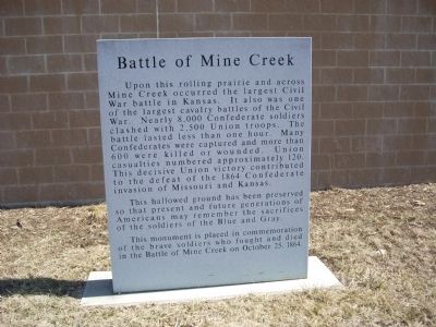
Upon this rolling prairie and across Mine Creek occurred the largest Civil War battle in Kansas. It also was one of the largest cavalry battles of the Civil War. Nearly 8,000 Confederate soldiers clashed with 2,500 Union troops. The battle lasted less than one hour. Many Confederates were captured and more than 600 were killed or wounded. Union casualties numbered approximately 120. This decisive Union victory contributed to the defeat of the 1864 Confederate invasion of Missouri and Kansas.
This hallowed ground has been preserved so that present and future generations of Americans may remember the sacrifices of the soldiers of the Blue and Gray.
This monument is placed in commemoration of the brave soldiers who fought and died in the Battle of Mine Creek on October 25, 1864.
Erected 2003 by Kansas Historical Society.
Topics. This historical marker is listed in this topic list: War, US Civil. A significant historical date for this entry is October 25, 1864.
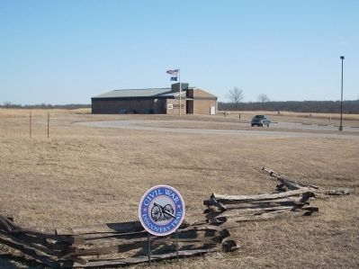
Location. 38° 8.702′ N, 94° 43.413′ W. Marker is in Pleasanton, Kansas, in Linn County. Marker can be reached from State Highway 52, half a mile west of U.S. 69. This marker is to the right of the entrance of the entrance to the Mine Creek Battlefield Visitor's Center as you enter. Touch for map. Marker is at or near this postal address: 20485 Kansas Highway 52, Pleasanton KS 66075, United States of America. Touch for directions.
Other nearby markers. At least 8 other markers are within walking distance of this marker. Mine Creek Battlefield Aerial Overlay (a few steps from this marker); Combat at State Line (a few steps from this marker); Price's Raid (a few steps from this marker); The Battle Begins (within shouting distance of this marker); Confederate Defeat (within shouting distance of this marker); After the Battle (within shouting distance of this marker); The Fort Scott Road (within shouting distance of this marker); Two Mounted Armies Collide (within shouting distance of this marker). Touch for a list and map of all markers in Pleasanton.
Also see . . .
1. Battle of Mine Creek. Wikipedia entry (Submitted on June 21, 2009, by Thomas Onions of Olathe, Kansas.)
2. Mine Creek Battlefield. Kansas Historical Society website entry (Submitted on June 21, 2009, by Thomas Onions of Olathe, Kansas.)
Credits. This page was last revised on January 16, 2022. It was originally submitted on June 21, 2009, by Thomas Onions of Olathe, Kansas. This page has been viewed 1,765 times since then and 41 times this year. Last updated on June 25, 2009, by Thomas Onions of Olathe, Kansas. Photos: 1, 2, 3, 4, 5. submitted on June 21, 2009, by Thomas Onions of Olathe, Kansas. • Syd Whittle was the editor who published this page.
