Parris Island in Beaufort County, South Carolina — The American South (South Atlantic)
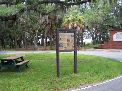
Parris Island Indians
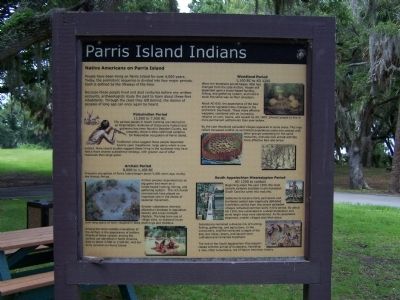
People have been living on Parris Island for over 4,000 years. Today, the prehistoric sequence is divided into four major periods. Each is defined by the lifeways of the time.
Because these people lived and died centuries before any written accounts, archaeologists study the past to learn about these first inhabitants. Through the clues they left behind, the stories of peoples of long ago can once again be heard.
Paleoindian Period
13,000 to 7,000 BC
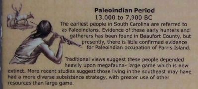
[Picture included] The earliest people in South Carolina are referred to as Paleoindians. Evidence of these early hunters and gatherers has been found in Beaufort County, but presently, there is little confirmed evidence for Paleoindian occupation of Parris Island.
Traditional views suggest these people depended heavily upon megafauna- large game which is now extinct. More recent studies suggest those living in the southeast may have had a more diverse subsistence strategy, with greater use of other resources than large game.
Archaic Period
8,000 to 1,100 BC
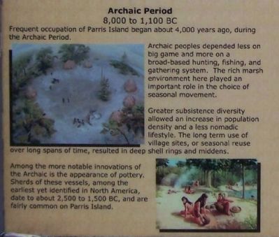
Frequent occupation of Parris Island began about 4,000 years ago, during the Archaic Period. Archaic peoples depended less on big game and more on a broad- based hunting, fishing and gathering system. The rich marsh environment here played an important role in the choice of seasonal movement.
Greater subsistence diversity allowed an increase in population density and a less nomadic lifestyle. The long term use of village sites, or seasonal reuse over long spans of time, resulted in deep shell rings and middens.
Among more notable innovations of the Archaic is the appearance of pottery. Sherds of these vessels, among the earliest yet identified in North America, date to about 2,500 to 1,500 BC, and are fairly common on Parris Island.
Woodland Period
1,100 BC to AD 1200
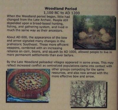
When the Woodland period began, little had changed from the Late Archaic. People still depended upon a broad-based hunting, fishing, and gathering system, and lived in much the same way as their ancestors.
About AD 600, the appearance of the bow and arrow signaled many changes in the prehistoric Southeast. These more efficient weapons, combined with an increasing reliance on corn, beans, and squash by AD 1000, allowed people to live in more permanent settlements than ever before.
By the Late Woodland palisaded villages appeared in some areas. This may reflect increased conflict as centralized populations came into contact with other groups competing for the same resources, and also now armed with the more effective bow and arrow.
South Appalachian Mississippian Period
AD 1200 to contact
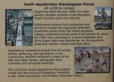
Beginning about the year 1200, the most socially complex societies in pre-European South Carolina came into maturity.
Settlers became fairly permanent and territorial control was vigorously defended. Intertribal conflict from this meant palisaded villages remained common early in this period. By about AD 1300, this culminated in a social breakdown and some larger sites were abandoned. As the population dispersed, smaller villages took their place.
Subsistence remained a diverse mix of hunting, fishing, gathering and agriculture. In the Lowcountry, shellfish remained a staple of the diet, but maize, beans, and squash were cultivated and remained important.
The end of the South Appalachian Mississippian closed with the arrival of Europeans, heralding a new, often tumultuous, era of Native American history.
Erected by U.S. Marine Corps Recruit Depot Parris Island.
Topics. This historical marker is listed in these topic lists: Exploration • Native Americans • Settlements & Settlers. A significant historical year for this entry is 1200.
Location. 32° 18.364′ N, 80° 40.548′ W. Marker is on Parris Island, South Carolina, in Beaufort County. Marker is on Balleau Wood Road, in the median.
Located at the east end of Balleau Wood Rd. at the circle. Touch for map. Marker is in this post office area: Parris Island SC 29905, United States of America. Touch for directions.
Other nearby markers. At least 8 other markers are within walking distance of this marker. Aqui Estuvo España (a few steps from this marker); Parris Island Plantations (a few steps from this marker); Fort San Marcos (a few steps from this marker); The First Inhabitants (a few steps from this marker); Jean Ribault Monument (within shouting distance of this marker); Charlesfort-Santa Elena Site (within shouting distance of this marker); Fort San Marcos & The Ribaut Monument (within shouting distance of this marker); Northern Most Known Bastion of Spanish Florida (within shouting distance of this marker). Touch for a list and map of all markers in Parris Island.
Credits. This page was last revised on June 16, 2016. It was originally submitted on July 7, 2009, by Mike Stroud of Bluffton, South Carolina. This page has been viewed 2,261 times since then and 46 times this year. Photos: 1, 2, 3, 4, 5, 6. submitted on July 7, 2009, by Mike Stroud of Bluffton, South Carolina. • Craig Swain was the editor who published this page.
