Marker Logo HMdb.org THE HISTORICAL
MARKER DATABASE
“Bite-Size Bits of Local, National, and Global History”
Near Owings Mills in Baltimore County, Maryland — The American Northeast (Mid-Atlantic)
 

Soldiers Delight


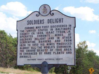
Soldiers Delight Marker image. Click for full size.
Photographed By Beverly Pfingsten, 08-12-2007
1. Soldiers Delight Marker
Inscription. Chrome was first discovered in the United States in Baltimore County circa 1808. Isaac Tyson, Jr. operated chromite mines at Soldiers Delight and in other serpentine barrens and from 1828 to 1850 his mines produced almost all the world’s chromium. The unique beauty of this area is enhanced by rare plants and animals.
 
Erected 1968 by Baltimore County Historical Society.
 
Topics. This historical marker is listed in these topic lists: AnimalsEnvironmentIndustry & Commerce. A significant historical year for this entry is 1808.
 
Location. 39° 24.864′ N, 76° 50.153′ W. Marker is near Owings Mills, Maryland, in Baltimore County. Marker is on Deer Park Road, half a mile south of Ward’s Chapel Road, on the right when traveling south. Touch for map. Marker is in this post office area: Owings Mills MD 21117, United States of America. Touch for directions.
 
Other nearby markers. At least 8 other markers are within 4 miles of this marker, measured as the crow flies. Mt. Paran Presbyterian Church and Cemetery (approx. 1.6 miles away); New Tavern (approx. 1.8 miles away); Original Bell of the Franklin Academy (approx. 2.6 miles away); Original Cornerstone of the Franklin Senior High School (approx. 2.6 miles away); Hannah More Academy (approx.
Paid Advertisement
Click on the ad for more information.
Please report objectionable advertising to the Editor.
Click or scan to see
this page online
2.7 miles away); Garrison Forest Church (approx. 3.4 miles away); John and Margaret Reister (approx. 3.4 miles away); Oldest High School in Baltimore County (approx. 3.4 miles away).
 
Also see . . .  Web site for Soldiers Delight. (Submitted on August 13, 2007, by Bill Pfingsten of Bel Air, Maryland.)
 
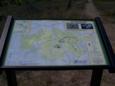
Map of the area image. Click for full size.
Photographed By Beverly Pfingsten, 08-12-2007
2. Map of the area
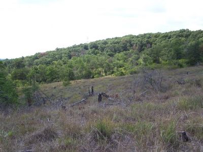
Barrens of Soldiers Delight image. Click for full size.
Photographed By Beverly Pfingsten, 08-12-2007
3. Barrens of Soldiers Delight
The ground is so rocky that trees are stunted.
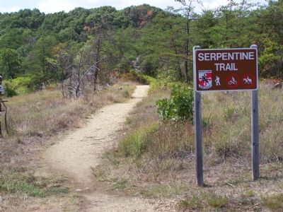
Trail marker at Soldiers Delight image. Click for full size.
Photographed By Beverly Pfingsten, 08-12-2007
4. Trail marker at Soldiers Delight
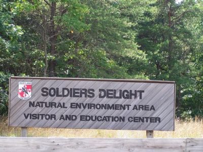
Visitors Center Sign image. Click for full size.
Photographed By Beverly Pfingsten, 08-12-2007
5. Visitors Center Sign
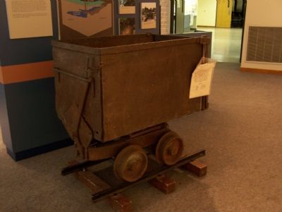
Mine Cart used to haul chromite. image. Click for full size.
Photographed By Beverly Pfingsten, 08-12-2007
6. Mine Cart used to haul chromite.
 
 
Credits. This page was last revised on November 22, 2019. It was originally submitted on August 13, 2007, by Bill Pfingsten of Bel Air, Maryland. This page has been viewed 3,352 times since then and 63 times this year. Photos:   1, 2, 3, 4, 5, 6. submitted on August 13, 2007, by Bill Pfingsten of Bel Air, Maryland. • J. J. Prats was the editor who published this page.
Share this page.  
Share on Tumblr
m=2073

CeraNet Cloud Computing sponsors the Historical Marker Database.
This website earns income from purchases you make after using our links to Amazon.com. We appreciate your support.
Paid Advertisement
May. 7, 2024