West Nyack in Rockland County, New York — The American Northeast (Mid-Atlantic)
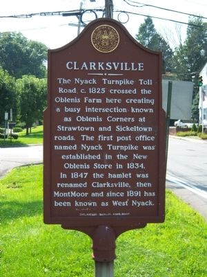
Clarksville
Erected 1982 by Historical Society of Rockland County. Sponsored by the West Nyack Rotary Club.
Topics and series. This historical marker is listed in this topic list: Roads & Vehicles. In addition, it is included in the New York, Historical Society of Rockland County, and the Rotary International series lists. A significant historical year for this entry is 1825.
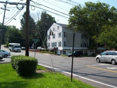
Location. 41° 5.634′ N, 73° 58.326′ W. Marker is in West Nyack, New York, in Rockland County. Marker is at the intersection of West Nyack Road and Strawtown Road, on the left when traveling west on West Nyack Road. The Marker is located at the southwest corner where West Nyack, Strawtown and Sickeltown Roads meet. Touch for map. Marker is in this post office area: West Nyack NY 10994, United States of America. Touch for directions.
Other nearby markers. At least 8 other markers are within walking distance of this marker. Clarksville Inn (within shouting distance of this marker); The Nyack Turnpike (approx. 0.2 miles away); West Nyack's Last Horse Trough (approx. 0.3 miles away); Van Houten Fields (approx. 0.3 miles away); The Old Parsonage (approx. half a mile away); West Nyack World War I Memorial (approx. 0.6 miles away); Clarkstown Reformed Church (approx. 0.6 miles away); Washington’s Encampment (approx. 0.7 miles away). Touch for a list and map of all markers in West Nyack.
Credits. This page was last revised on June 16, 2016. It was originally submitted on August 4, 2009, by Historical Society of Rockland County of New City, New York. This page has been viewed 2,342 times since then and 38 times this year. Photos: 1, 2. submitted on August 4, 2009, by Historical Society of Rockland County of New City, New York. • Bill Pfingsten was the editor who published this page.

