Wellsburg in Brooke County, West Virginia — The American South (Appalachia)
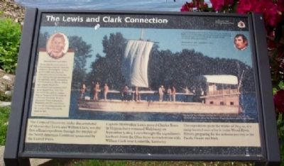
The Lewis and Clark Connection
Inscription.
The Corps of Discovery, under the command of Meriwether Lewis and William Clark, was the first official expedition through the interior of the North American Continent sponsored by the United States.
Captain Meriwether Lewis passed Charles Town in Virginia (later renamed Wellsburg) on September 7, 1803. Lewis brought the expedition's keelboat down the Ohio River to rendezvous with William Clark near Louisville, Kentucky.
The expedition spent the winter of 1803-04 at a camp located near what is today Wood River, Illinois, preparing for the arduous journey to the Pacific Ocean and back.
...passed Charles town on the E. shore above the mouth of the mouth of the Buffaloe over which there is built a handsom wooden bridge, this has the appearance of a handsome little village, containing about forty houses.... Meriwether Lewis, September 7, 1803
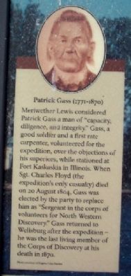
[Text at Photo of Patrick Gass:]
Patrick Gass (1771-1870) Meriwether Lewis considered Patrick Gass a man of “capacity, diligence, and integrity.” Gass, a good soldier and a first rate carpenter, volunteered for the expedition, over the objections of his superiors, while stationed at Fort Kaskaskia in Illinois. When Sgt. Charles Floyd (the expedition's only casualty) died on 20 August 1804, Gass was elected by the party to replace him as “Sergeant in the corps of volunteers for North Western Discovery.” Gass returned to Wellsburg after the expedition - he was the last living member of the Corps of Discovery at his death in 1870.
Erected by National Park Service.
Topics and series. This historical marker is listed in these topic lists: Exploration • Patriots & Patriotism • Science & Medicine • Settlements & Settlers. In addition, it is included in the Lewis & Clark Expedition series list. A significant historical date for this entry is September 7, 1803.
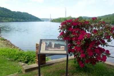
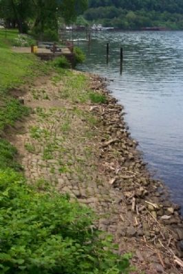
Location. 40° 16.151′ N, 80° 36.868′ W. Marker is in Wellsburg, West Virginia, in Brooke County. Marker is at the intersection of Main Street and 6th Street, on the right when traveling south on Main Street. Marker is on the remnants of one of the Wellsburg Wharfs. Touch for map. Marker is in this post office area: Wellsburg WV 26070, United States of America. Touch for directions.
Other nearby markers. At least 8 other markers are within walking distance of this marker. Patrick Gass (a few steps from this marker); Wellsburg's Giant Sycamore (a few steps from this marker); Wellsburg Wharf (within shouting distance of this marker); Miller's Tavern (within shouting distance of this marker); 1788 Wells Log House (about 300 feet away, measured in a direct line); 1849 (about 300 feet away); Wellsburg (approx. ¼ mile away); Isaac Duvall and Company (approx. ¼ mile away). Touch for a list and map of all markers in Wellsburg.
Also see . . .
1. Wellsburg, West Virginia. Wikipedia entry (Submitted on January 30, 2022, by Larry Gertner of New York, New York.)
2. What did the Lewis and Clark expedition accomplish?. Colors New York website entry (Submitted on January 30, 2022, by Larry Gertner of New York, New York.)
Credits. This page was last revised on January 30, 2022. It was originally submitted on August 14, 2009, by William Fischer, Jr. of Scranton, Pennsylvania. This page has been viewed 1,520 times since then and 33 times this year. Photos: 1, 2, 3, 4. submitted on August 14, 2009, by William Fischer, Jr. of Scranton, Pennsylvania. • Syd Whittle was the editor who published this page.


