Marietta in Washington County, Ohio — The American Midwest (Great Lakes)
Mighty River / Learning the River
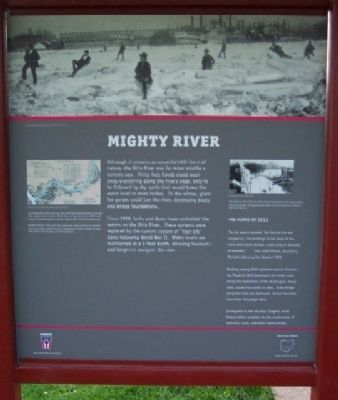
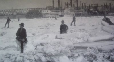
Although it remains an unpredictable force of nature, the Ohio River was far more volatile a century ago. Thirty-foot floods could wash away everything along the river's edge, only to be followed by dry spells that would lower the water level to mere inches. In the winter, giant ice gorges could jam the river, destroying boats and bridge foundations.
Since 1929, locks and dams have controlled the waters on the Ohio River. These systems were replaced by the current system of “high lift” dams following World War II. Water levels are maintained at a 9-foot depth, allowing towboats and barges to navigate the river.
The Flood of 1913
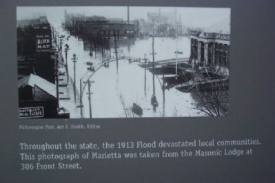
“As the waters receded, the destruction was staggering. The buildings in the heart of the town were either burned, swept away or denuded of contents.” - Sara Leake Wilson, describing Marietta following the Flood of 1913
Ranking among Ohio's greatest natural disasters, the Flood of 1913 devastated the entire state. Along the headwaters of the Muskingum, heavy rains caused the waters to swell. Every bridge along the river was destroyed. Across the state, more than 400 people died.
In response to this disaster, Congress made federal dollars available for the construction of reservoirs, dams, and other improvements.
“Your true pilot cares nothing about anything on earth but the river, and his pride in his occupation surpasses the pride of kings.” - Mark Twain, Life on the Mississippi
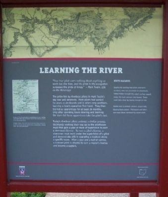
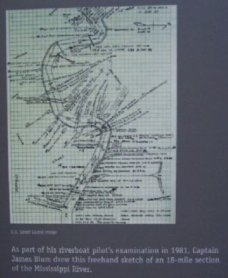
The pride felt by riverboat pilots in Mark Twain's day was well-deserved. Most pilots had worked for years as deckhands and in other crew positions, learning a boat's operation first hand. They then trained as apprentices for at least 36 months. Only after spending hours steering and learning the river did these apprentices take the pilot's test.
Today's riverboat pilots undergo a similar process. Deckhands working their way up to the pilothouse must first gain a year or more of experience to earn a steersman license. To earn a pilot's license, a steersman must work under the supervision of a pilot and demonstrate skill in operating a towboat along a specific route. After a year and a half of service, a licensed pilot is eligible to earn a master's license and become a captain.
River Hazards
Despite the training that pilots underwent, accidents were not uncommon on steamboats. Timber hidden beneath the water's surface caused snags, the most common river hazard. Snags could sink a boat by ripping through its hull.
Storms were a common concern, occasionally blowing boats ashore. Pilothouses and pilots were even blown overboard by severe winds.
Erected by The Ohio Historical Society.
Topics. This historical marker is listed in these topic lists: Disasters • Industry & Commerce • Waterways & Vessels. A significant historical year for this entry is 1929.
Location. 39° 25.231′ N, 81° 27.788′ W. Marker is in Marietta, Ohio, in Washington County. Marker is on the grounds of the Ohio River Museum, 601 Front Street. Touch for map. Marker is in this post office area: Marietta OH 45750, United States of America. Touch for directions.
Other nearby markers. At least 8 other markers are within walking distance of this marker. River Town / Sails and Steam / The Highway West (here, next to this marker); Flood Heights (a few steps from this marker); The Towboat W. P. Snyder Jr. (a few steps from this marker); Life on the River / Boats on the Ohio (a few steps from this marker); The W. P. Snyder Jr. (a few steps from this marker); Tour of the Snyder (a few steps from this marker); Oldest Pilothouse (a few steps from this marker); Oweva Engine (a few steps from this marker). Touch for a list and map of all markers in Marietta.
Photographed By William Fischer, Jr., May 30, 2009
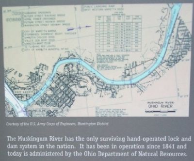
5. Muskingum River Diagram on Mighty River Marker
"The Muskingum River has the only surviving hand-operated lock and dam system in the nation. It has been in operation since 1841 and today is administered by the Ohio Department of Natural Resources."
Credits. This page was last revised on January 21, 2020. It was originally submitted on August 15, 2009, by William Fischer, Jr. of Scranton, Pennsylvania. This page has been viewed 1,576 times since then and 17 times this year. Photos: 1, 2, 3, 4, 5, 6, 7. submitted on August 15, 2009, by William Fischer, Jr. of Scranton, Pennsylvania. • Bill Pfingsten was the editor who published this page.
