Atco in Bartow County, Georgia — The American South (South Atlantic)
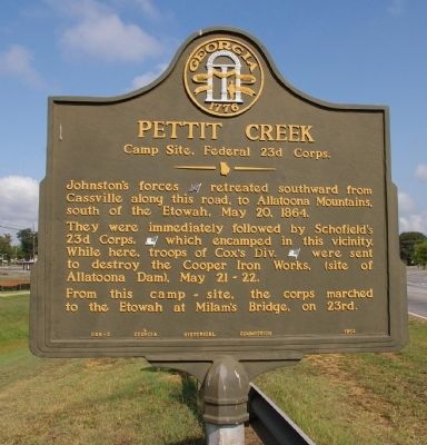
Pettit Creek
Camp Site, Federal 23d Corps.
They were immediately followed by Schofield’s 23d Corps, [US] which encamped in this vicinity. While here, troops of Cox’s Div. [US] were sent to destroy the Cooper Iron Works, (site of Allatoona Dam), May 21-22.
From this camp-site, the corps marched to the Etowah at Milam’s Bridge, on 23rd.
Erected 1952 by Georgia Historical Commission. (Marker Number 008-3.)
Topics and series. This historical marker is listed in this topic list: War, US Civil. In addition, it is included in the Georgia Historical Society series list. A significant historical date for this entry is May 20, 1784.
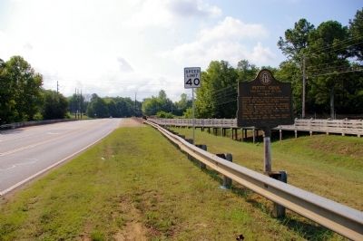
Location. 34° 10.774′ N, 84° 48.894′ W. Marker is in Atco, Georgia, in Bartow County. Marker is on Cassville Road (Georgia Route 293) 0.1 miles south of Goodyear Avenue, on the right when traveling south. Touch for map. Marker is in this post office area: Cartersville GA 30120, United States of America. Touch for directions.
Other nearby markers. At least 8 other markers are within 2 miles of this marker, measured as the crow flies. Ebenezer Methodist Church (approx. 0.4 miles away); Pierce Manning Butler Young, (1836-1896) (approx. 0.4 miles away); John W. Akin (approx. half a mile away); Home of Sam P. Jones (approx. 1.2 miles away); Site of Sam Jones' Tabernacle (approx. 1.3 miles away); First Presbyterian Church (approx. 1.4 miles away); Bartow County (approx. 1.4 miles away); Old Bartow County Courthouse (approx. 1.4 miles away).
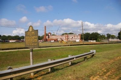
Regarding Pettit Creek. Atco a small community, was named for the American Textile Company, founded in the early 20th century. The community was built around the mill in a pattern typical of Georgia mill towns. The American Textile Company was purchased by the Goodyear Tire & Rubber Company prior to the mid-1930s. The mill is now closed, and Atco is a surburb of Cartersville.
Credits. This page was last revised on June 16, 2016. It was originally submitted on August 16, 2009, by David Seibert of Sandy Springs, Georgia. This page has been viewed 1,665 times since then and 29 times this year. Photos: 1, 2, 3. submitted on August 16, 2009, by David Seibert of Sandy Springs, Georgia. • Craig Swain was the editor who published this page.


