Near Stafford in Stafford County, Virginia — The American South (Mid-Atlantic)
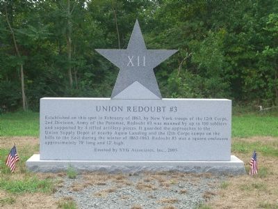
Union Redoubt # 3
Erected 2005 by SYG Associates Inc.
Topics. This historical marker is listed in these topic lists: Military • War, US Civil. A significant historical month for this entry is February 1863.
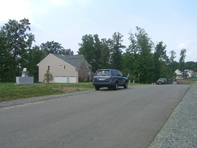
Location. 38° 22.605′ N, 77° 20.111′ W. Marker is near Stafford, Virginia, in Stafford County. Marker is on Sentinel Ridge Road north of Brooke Road (County Route 608). Touch for map. Marker is at or near this postal address: 57 Sentinel Ridge Ln, Stafford VA 22554, United States of America. Touch for directions.
Other nearby markers. At least 8 other markers are within walking distance of this marker. Union Redoubt No. 3 (approx. ¼ mile away); John Smith Explores the Chesapeake (approx. 0.4 miles away); Crow's Nest Natural Area Preserve / Virginia’s State Natural Area Preserves (approx. 0.4 miles away); Crow's Nest (approx. half a mile away); Union XIIth Corps Winter Camp (approx. 0.6 miles away); Redoubt # 2 (approx. 0.8 miles away); Mason's Homestead (approx. 0.9 miles away); Aquia Landing (approx. 0.9 miles away). Touch for a list and map of all markers in Stafford.
More about this marker. Monument is made out of Vermont Granite. The Star is 3 feet, 6 inches wide, and the base is 9 feet by 2 feet, 4 inches. Total Height is 6 feet, 10 inches.
Regarding Union Redoubt # 3. Remains of the redoubt were destroyed in 2005. Apparently the 70 foot long, 12 foot high redoubt surrounded by a moat and exterior gun positions was never found nor was any request made by Stafford County to preserve it. The developer stated that they “would have worked around the site had it known” prior to developing the site. Efforts to preserve what remained, and to identify the site as historical, identified that partnership with developers to save historically significant areas through citizen and developer cooperation. Stafford County now requires developers to survey the land in cooperation with historians and identify potential areas for future historical markers.
Also see . . . Marker Dedication Ceremony. (Submitted on August 29, 2007, by Kevin W. of Stafford, Virginia.)
Credits. This page was last revised on May 24, 2022. It was originally submitted on August 28, 2007, by Kevin W. of Stafford, Virginia. This page has been viewed 1,904 times since then and 34 times this year. Photos: 1, 2. submitted on August 28, 2007, by Kevin W. of Stafford, Virginia. • J. J. Prats was the editor who published this page.

