Laurel in Prince George's County, Maryland — The American Northeast (Mid-Atlantic)
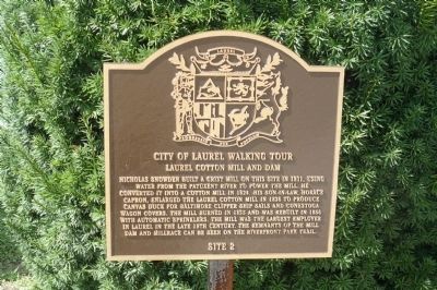
Laurel Cotton Mill and Dam
City of Laurel Walking Tour
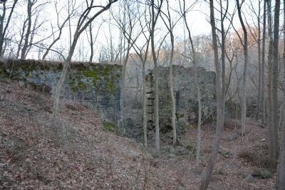
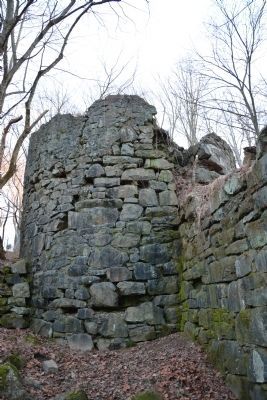
Nicholas Snowden built a grist mill on this site in 1811, using water from the Patuxent River to power the mill. He converted it into a cotton mill in 1824. His son-in-law, Horace Capron, enlarged the Laurel Cotton Mill in 1836 to produce canvas duck for Baltimore Clipper ship sails and Conestoga wagon covers. The mill burned in 1855 and was re-built in 1856 with automatic sprinklers. The mill was the largest employer in Laurel in the late 19th century. The remnants of the mill dam and millrace can be seen on the Riverfront Park Trail.
Erected by City of Laurel, Maryland. (Marker Number 2.)
Topics. This historical marker is listed in these topic lists: Industry & Commerce • Settlements & Settlers • Waterways & Vessels. A significant historical year for this entry is 1811.
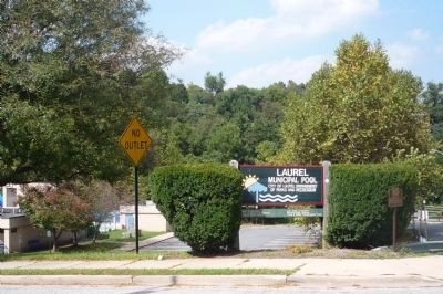
Location. 39° 6.581′ N, 76° 51.451′ W. Marker is in Laurel, Maryland, in Prince George's County. Marker is at the intersection of Main Street and 9th Street, on the right when traveling west on Main Street. Touch for map. Marker is in this post office area: Laurel MD 20707, United States of America. Touch for directions.
Other nearby markers. At least 8 other markers are within walking distance of this marker. Desegregation of Laurel Pool (here, next to this marker); Laurel Factory: Prince Georges County's Only Mill Town (here, next to this marker); Laurel Factory: A Mill Town (a few steps from this marker); Casula Point (about 300 feet away, measured in a direct line); Laurel: A Factory Town Bridging Two Counties (about 300 feet away); Laurel Harnessed the River to Power the Cotton Mill (about 300 feet away); Water From the Dam Powered the Cotton Mill (about 500 feet away); Methodism in Laurel (about 500 feet away). Touch for a list and map of all markers in Laurel.
Also see . . .
1. Walking Tour of Historic Laurel. City website entry (Submitted on March 4, 2024, by Larry Gertner of New York, New York.)
2. History of Laurel. City of Laurel's website entry (Submitted on March 3, 2014, by A. Taylor of Laurel, Maryland.)
Credits. This page was last revised on March 4, 2024. It was originally submitted on September 17, 2009, by Richard E. Miller of Oxon Hill, Maryland. This page has been viewed 1,746 times since then and 93 times this year. Photos: 1, 2. submitted on September 17, 2009, by Richard E. Miller of Oxon Hill, Maryland. 3, 4. submitted on March 3, 2014, by A. Taylor of Laurel, Maryland. • Kevin W. was the editor who published this page.


