Plymouth in Marshall County, Indiana — The American Midwest (Great Lakes)
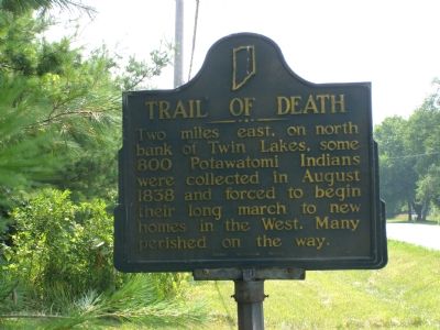
Trail of Death
Erected 1949 by Indiana Historical Bureau. (Marker Number 50.1949.1.)
Topics and series. This historical marker is listed in this topic list: Native Americans. In addition, it is included in the Indiana Historical Bureau Markers, and the Potawatomi Trail of Death series lists. A significant historical year for this entry is 1838.
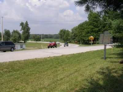
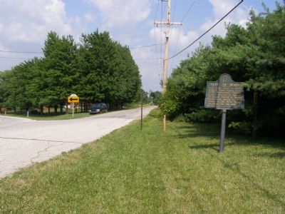
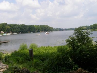
Location. Marker has been reported missing. It was located near 41° 18.166′ N, 86° 24.432′ W. Marker was in Plymouth, Indiana, in Marshall County. Marker was at the intersection of West 12th (State Road 17) and Hiawatha on West 12th. The marker is located on the south side of State Route 17 where it bends from being Sycamore (north-south) bends west and become State Route 17 as West 12th (east-west). Touch for map. Marker was in this post office area: Plymouth IN 46563, United States of America. Touch for directions.
Other nearby markers. At least 8 other markers are within 6 miles of this location, measured as the crow flies. Plymouth Firemans Memorial (approx. 2 miles away); Chief Menominee (approx. 2.4 miles away); Potawatomi Indian Village (approx. 2.4 miles away); Plymouth's First Fire Alarm (approx. 5.7 miles away); Honor Roll - Marshall County Indiana (approx. 5.7 miles away); Replica of The Statue of Liberty (approx. 5.7 miles away); Marshall County 9-11 Memorial (approx. 5.7 miles away); First Meeting of Marshall County (approx. 5.8 miles away). Touch for a list and map of all markers in Plymouth.
Also see . . . Potawatomi Trail of Death March. Website includes short narative history and four-state map. (Submitted on September 6, 2007.)
Credits. This page was last revised on July 13, 2021. It was originally submitted on September 4, 2007, by Christopher Light of Valparaiso, Indiana. This page has been viewed 3,248 times since then and 39 times this year. Photos: 1, 2, 3, 4. submitted on September 4, 2007, by Christopher Light of Valparaiso, Indiana. • J. J. Prats was the editor who published this page.


