Near Cambridge in Washington County, Idaho — The American West (Mountains)
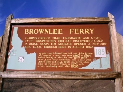
Brownlee Ferry
A gold rush followed that fall, and John Brownlee operated a ferry here from 1862 to 1864, before leaving to work his own Boise Basin mine. A new ferry commenced here a year after James Ruth and T.J. Heath discovered silver mines on Brownlee Creek in 1874, with service continuing until after 1920.
Erected by Idaho Historical Society. (Marker Number 185.)
Topics and series. This historical marker is listed in these topic lists: Roads & Vehicles • Settlements & Settlers. In addition, it is included in the Idaho State Historical Society, and the Oregon Trail series lists. A significant historical year for this entry is 1862.
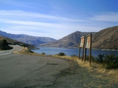
Location. 44° 49.725′ N, 116° 54.209′ W. Marker is near Cambridge, Idaho, in Washington County. Marker is on State Highway 71 at milepost 2,, 10 miles west of Camp Creek Road, on the left when traveling north. Marker is 28 miles from Cambridge near Brownlee Dam. Touch for map. Marker is in this post office area: Cambridge ID 83610, United States of America. Touch for directions.
Other nearby markers. At least 1 other marker is within walking distance of this marker. Seven Devils Mines (here, next to this marker).
Credits. This page was last revised on June 16, 2016. It was originally submitted on October 12, 2009, by Rebecca Maxwell of Boise, Idaho. This page has been viewed 2,798 times since then and 44 times this year. Photos: 1, 2. submitted on October 12, 2009, by Rebecca Maxwell of Boise, Idaho. • Craig Swain was the editor who published this page.

