Shockoe Slip in Richmond, Virginia — The American South (Mid-Atlantic)
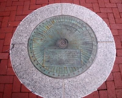
Triple Crossing
Erected by Richmond Riverfront Canal Walk.
Topics. This historical marker is listed in these topic lists: Industry & Commerce • Railroads & Streetcars.
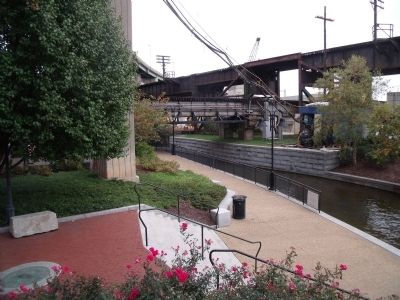
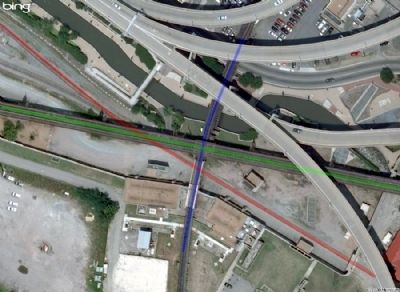
Location. 37° 31.943′ N, 77° 25.89′ W. Marker is in Richmond, Virginia. It is in Shockoe Slip. Marker can be reached from the intersection of Dock Street and South 15th Street. This marker is on the Richmond Riverfront Canal Walk between S 15th Street and S 17th Street. Touch for map. Marker is in this post office area: Richmond VA 23219, United States of America. Touch for directions.
Other nearby markers. At least 8 other markers are within walking distance of this marker. In a wooden crate similar to this one… (a few steps from this marker); James River & Kanawha Canal (a few steps from this marker); African Americans and the Waterfront (within shouting distance of this marker); Shockoe Slip (about 300 feet away, measured in a direct line); Early Shockoe (about 300 feet away); Mayo's Bridge (about 400 feet away); Davenport Trading Company (about 400 feet away); Auction Houses (about 400 feet away). Touch for a list and map of all markers in Richmond.
Also see . . .
1. Richmond’s Historic Canal Walk. Venture Richmond (Submitted on October 31, 2009.)
2. Triple Crossing. Wikipedia (Submitted on October 31, 2009.)
3. The Triple Crossing. Chesapeake & Ohio Piedmont Subdivision - Richmond (Submitted on October 31, 2009.)
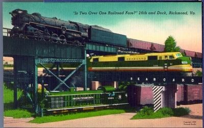
Photographed By Dementi Studios, circa 1950
3. Triple Crossing
This unique photograph presents to view the only point in the world where three trunk line trains may cross each other, at the same time and over their separate tracks. At the top is shown a passenger train of the C & O Railway leaving Richmond for the upper James River Valley; just beneath is a train of the S.A.L. Railway leaving the Main Street (Union) Depot for the South, and on the ground a train of the Southern Railway coming into Richmond from West Point on the York River. VCU Libraries Digital Collections - Rarely Seen Richmond
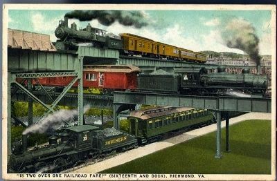
Photographed By Southern Bargain House, circa 1919
4. Triple Crossing
This unique photograph presents to view the only point in the world where three trunk line trains cross each other at the same time, and over their separate tracks. At the top is shown a passenger train of the C. & O. Railway leaving Richmond for the upper James River Valley just beneath it a train of the S.A.L. Railway leaving the Main Street (Union) Deport for the South, and on the ground a train of the Southern Railway coming into Richmond from West Point on the York River. VCU Libraries Digital Collections - Rarely Seen Richmond
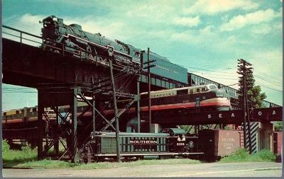
Photographed By Capitol News Agency
5. Triple Crossing
This unique photograph presents to view the only point in the world where three trunk line trains cross each other, at the same time and over their separate tracks. At the top is shown a passenger train of the C. & O. Railway leaving Richmond for the upper James River Valley just beneath it a train of the S.A.L. Railway leaving the Main Street (Union) Deport for the South, and on the ground a train of the Southern Railway coming into Richmond from West Point on the York River. VCU Libraries Digital Collections - Rarely Seen Richmond
Photographed By Jack E. Boucher, 1971
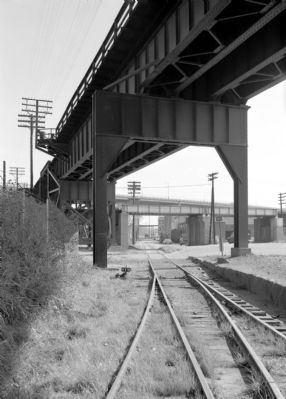
6. Triple Railroad Crossing, East Byrd Street at Sixteenth Street.
General view, looking east, showing intersection of three railroads at three levels. At ground level is the former Richmond & York River Railroad (now the West Point branch of the Southern); the viaduct structure appearing at the upper left corner of the photograph was constructed by the Chesapeake & Ohio railroad in 1900. It passes over the Seaboard Airline Bridge which also was built in 1900. Library of Congress [HAER VA,44-RICH,105-2]
Credits. This page was last revised on February 1, 2023. It was originally submitted on October 31, 2009, by Bernard Fisher of Richmond, Virginia. This page has been viewed 3,240 times since then and 163 times this year. Photos: 1, 2, 3, 4, 5. submitted on October 31, 2009, by Bernard Fisher of Richmond, Virginia. 6. submitted on November 2, 2009, by Bernard Fisher of Richmond, Virginia. 7. submitted on October 31, 2009, by Bernard Fisher of Richmond, Virginia.
