Civic Center in Manhattan in New York County, New York — The American Northeast (Mid-Atlantic)
Windmill
Birth of a City: Nieuw Amsterdam & Old New York
Inscription.
INTRODUCTION
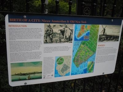
In September 1609, Henry Hudson and some 20 seamen sailed their ship, the Halve Maen (Half Moon), into what is today New York harbor. The Dutch East India Company expected Hudson to find a passage to Asia. Instead, his voyage allowed the Dutch to claim a territory they would call Nieuw Nederland – today parts of New York, New Jersey, Pennsylvania, Delaware, and Connecticut. In 1625-26, the new Dutch West India Company established an outpost here at Manhattan’s tip to function as the colony’s capital and trading center. They called the town Nieuw Amsterdam. It would become New York City.
Between 1625 and 1664, Nieuw Amsterdam became a thriving community of some 2,000 merchants, craftsmen, shopkeepers, farmers, laborers, slaves, and families. Walloon, Flemish, French, German, Bohemian, British, Scandinavian, and Jewish migrants joined Dutch settlers. The houses, canals, and windmills built here put a Dutch imprint on the land. In 1664, and English fleet conquered the colony in the name of the Duke of York. But Dutch cultural traditions, and the town’s early ethnic and religious diversity, continued to shape New York’s history and identity.
The Dutch legacy in New York was complex. The Dutch traded with Indians, but also fought them. They imported enslaved Africans to toil for them, but also allowed some to gain freedom and own land. Jewish refugees settled, but Director-General Petrus Stuyvesant granted them rights only after authorities in the Netherlands ordered him to do so. Through conflict and compromise, the Dutch established a community that over time would become one of the world’s great cities.
In celebration of Hudson’s voyage of discovery 400 years ago, this self guided walking tour will take you to 12 sites in lower Manhattan that were important in the daily life of Dutch Nieuw Amsterdam. The map shows the location of each of these sites, where you will find a sign explaining its history.
Sidebar:
WINDMILL
Location: City Hall Park
Dutch Name: Buyten de Landtpoort (Beyond the Land Gate)
One of the most familiar features of the Dutch landscape that colonists brought with them was the windmill. One such mill, built by carpenters near this spot in 1663-64, replaced an earlier one first erected before 1628 along the Beaver’s Path at Manhattan’s tip. The windmill here, on the “common lands” outside the city limits, continued to grind flour after the English took Nieuw Amsterdam from the Dutch in 1664.
Windmills were highly functional structures, turning wheat and rye grown by Dutch settlers into flour for bread, cakes, and the sweets known as koeckjes – a word that later
entered New Yorkers’ vocabulary as “cookies.” Mills also ground the grain used to brew beer, one of Nieuw Amsterdam’s favorite beverages. Mills thus became important in the local economy, as farmers who had settled in the countryside of upper Manhattan and Long Island brought their crops for milling.
Erected 2009 by City Lore & NY 400.
Topics. This historical marker is listed in this topic list: Colonial Era. A significant historical month for this entry is September 1609.
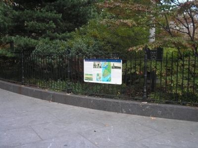
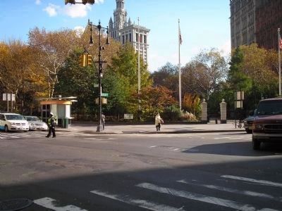
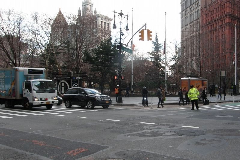
Location. Marker has been reported permanently removed. It was located near 40° 42.72′ N, 74° 0.469′ W. Marker was in Manhattan, New York, in New York County. It was in Civic Center. Marker was at the intersection of Broadway and Barclay Street, on the left when traveling south on Broadway. Marker was on the fence at the southern end of City Hall Park. Touch for map. Marker was in this post office area: New York NY 10279, United States of America.
We have been informed that this sign or monument is no longer there and will not be replaced. This page is an archival view of what was.
Other nearby markers. At least 8 other markers are within walking distance of this location. New York City Hall Park (a few steps from this marker); October 29, 1999 (within shouting distance
of this marker); November 16, 1998 (within shouting distance of this marker); October 30, 2000 (within shouting distance of this marker); February 5, 2008 (within shouting distance of this marker); February 7, 2012 (within shouting distance of this marker); October 23, 1998 (within shouting distance of this marker); The Croton Fountain 1842-1870 (within shouting distance of this marker). Touch for a list and map of all markers in Manhattan.
More about this marker. Several pictures appear on the marker. A picture of a windmill can be seen at the upper right, above the sidebar. The bottom left corner of the marker contains a watercolor painting depicting the East River shore of Nieuw Amsterdam during the mid-17th century, with the fort in the left background. A picture in the upper center has a caption of “Enslaved Africans are seen in the lower background of this view of Nieuw Amsterdam, c. 1630.” Several maps at the bottom of the marker show lower Manhattan Island and the route of the Nieuw Amsterdam Trail.
NOTE: By December 2018, all the markers in this series had
been removed.
Related markers. Click here for a list of markers that are related to this marker. Learn about New York City’s colonial Dutch heritage by taking a virtual tour of the Nieuw Amsterdam Trail though lower Manhattan.
Also see . . . City Lore website. City Lore's mission is to foster New York's - and America's - living cultural heritage. (Submitted on November 3, 2009, by Bill Coughlin of Woodland Park, New Jersey.)
Additional commentary.
1. The Nieuw Amsterdam Trail
Birth of a City is a creation of City Lore, in collaboration with HH400 and the Hudson-Fulton-Champlain Quadricentennial Commission. It is funded by the Consulate General of the Netherlands and the New York Council for the Humanities. (Any views, findings, conclusions or recommendations expressed in the exhibit do not necessarily represent those of the National Endowment for the Humanities.) The curator is historian Steven H. Jaffe, Ph.D. and design is by Emphasis Design in Brooklyn. The mapmaker is Jos Ruks. The exhibit is made possible through the cooperation of New York City Department of Parks & Recreation and the New York City Department of Transportation. Special thanks to Gajus Scheltema, Consol General of The Netherlands, historian Jaap Jacobs,
Marille-vander Linden, and Femle Smeets; George Fertitta, NYC & Company; Joan K. Davidson and Liz McEnaney, Quadricentennial Commission; Margaret Newman and Anthony Galgan, NYC Department of Transportation; Jonathan Kuhn and Clare Weiss, NYC Department of Parks & Recreation.
— Submitted November 3, 2009, by Bill Coughlin of Woodland Park, New Jersey.
Credits. This page was last revised on January 31, 2023. It was originally submitted on November 3, 2009, by Bill Coughlin of Woodland Park, New Jersey. This page has been viewed 1,436 times since then and 82 times this year. Last updated on December 17, 2018, by Larry Gertner of New York, New York. Photos: 1, 2. submitted on November 3, 2009, by Bill Coughlin of Woodland Park, New Jersey. 3, 4. submitted on November 5, 2009, by Bill Coughlin of Woodland Park, New Jersey. 5. submitted on December 17, 2018, by Larry Gertner of New York, New York. • Bill Pfingsten was the editor who published this page.
