Shaw in Northwest Washington in Washington, District of Columbia — The American Northeast (Mid-Atlantic)
Community Anchors
Midcity at the Crossroads
— Shaw Heritage Trail —
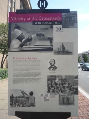
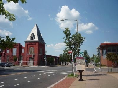
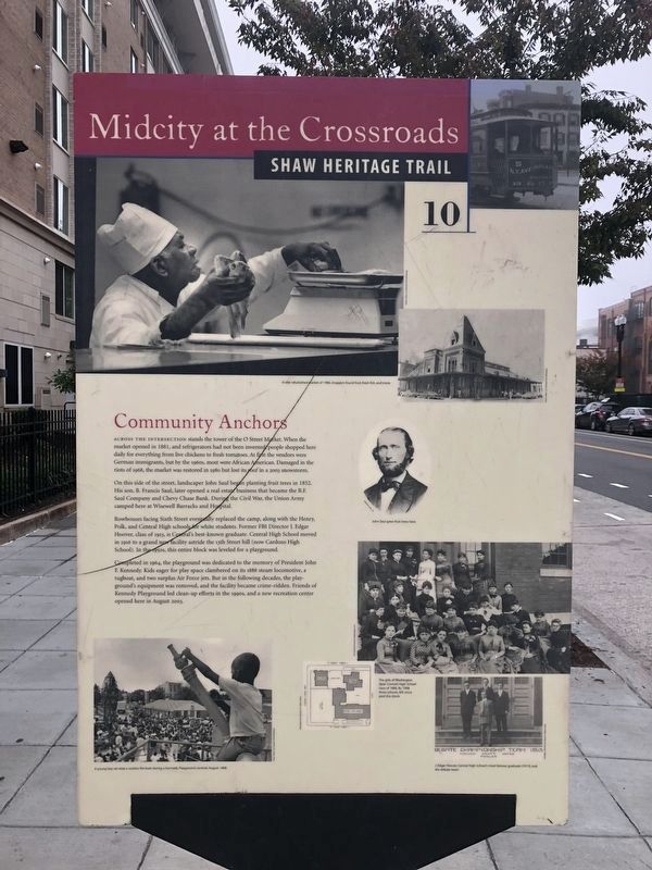
Across the intersection stands the tower of O Street Market. When the market opened in 1881, and refrigerators had not been invented, people shopped here daily for everything from live chickens to fresh tomatoes. At first the vendors were German immigrants, but by the 1960s, most were African American. Damaged in the riots of 1968, the market was restored in 1980 but lost its roof in a 2003 snow storm.
On this side of the street, landscaper John Saul began planting fruit trees in 1852. His son, B. Francis Saul, later opened a real estate that became the B.F. Saul Company and Chevy Chase Bank. During the Civil War, the Union Army camped here at Wisewell Barracks and Hospital.
Rowhouses facing Sixth Street eventually replaced the camp, along with the Henry, Polk, and Central High schools for White students. Former FBI Director J. Edgar Hoover, class of 1913, is Central’s best-known graduate. Central High School moved in 1926 to a grand new facility astride the 13th Street hill (now Cardozo High School). In the 1950s, this entire block was leveled for a playground.
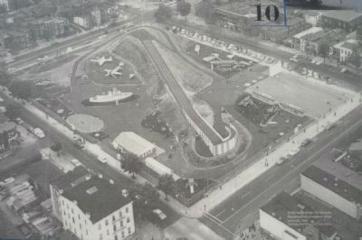
Completed in 1964, the playground was dedicated to the memory of President John F. Kennedy. Kids eager for play space clambered on its 1888 steam locomotive, a tugboat, and two surplus Air Force jets. But in the following decades, the playground’s equipment was removed, and the facility became crime-ridden. Friends of Kennedy Playground led clean-up efforts in the 1990s, and a new recreation center opened her in August 2003.
Erected 2006 by Cultural Tourism DC. (Marker Number 10.)
Topics and series. This historical marker is listed in these topic lists: Education • Entertainment • Industry & Commerce • War, US Civil. In addition, it is included in the Former U.S. Presidents: #35 John F. Kennedy, and the Shaw Heritage Trail series lists. A significant historical year for this entry is 1881.
Location. 38° 54.505′ N, 77° 1.309′ W. Marker has been reported damaged. Marker is in Northwest Washington in Washington, District of Columbia. It is in Shaw. Marker is at the intersection of 7th Street Northwest and O Street Northwest, on the right when traveling north on 7th Street Northwest. Touch for map. Marker is at or near this postal address: 600 O St NW, Washington DC 20001, United States of America. Touch for directions.
Other nearby markers. At least 8 other markers are within walking distance of this location. Immaculate Conception Catholic School (about 400 feet away, measured in a direct line); Immaculate Conception Catholic Church (about 500 feet away); Seventh Street Develops (about 500 feet away); The Fires of 1968 (about 500 feet away); Alley Life
Photographed By Devry Becker Jones (CC0), October 22, 2020
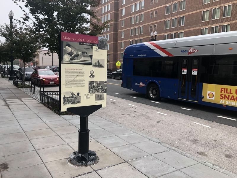
2. Community Anchors Marker
Unfortunately the marker has been damaged but remains legible.
More about this marker.
[ Photo Captions, front of marker:]
In the refurbished market of 1980, shoppers found fruit, fresh fish, and more. (Washingtoniana Division, D.C. Public Library.)
John Saul grew fruit trees here. (B. F. Saul Collection.)
The girls of Washington [later Central] High School class of 1886. (Historical Society of Washington, D.C.) By 1908 three schools, left occupied this block. (Washingtoniana Division, D.C. Public Library.)
J. Edgar Hoover, Central High School’s most famous graduate (1913), and the debate team. (Paul K. Williams, Kelsey and Associates Collection.)
A young boy sat atop a surplus fire boat during a Kennedy Playground carnival, August, 1968. (Washingtoniana Division, D.C. Public Library.)
[ Photo caption on reverse of marker:]
At the center of the first Kennedy Playground was a soapbox derby racetrack, 1964.
Photographed By Devry Becker Jones (CC0), October 22, 2020
3. Community Anchors Marker
The reverse side of the marker has been heavily damaged and is no longer legible.
Related marker. Click here for another marker that is related to this marker. To better understand the relationship, study each marker in the order shown.
Also see . . . J. Edgar Hoover. Wikipedia biography (Submitted on November 8, 2009, by Richard E. Miller of Oxon Hill, Maryland.)
Additional keywords. racial segregation.
Photographed By Richard E. Miller, August 16, 2009
6. Community Anchors Marker - reverse
Aerial photo of the first J.F.K. community playground, northeast of marker.
"Plans to Redevelop O Street Market Are Met With Cautious Optimism"
Washington Post Metro Section article
Click for more information.
Washington Post Metro Section article
Click for more information.
Credits. This page was last revised on January 30, 2023. It was originally submitted on November 8, 2009, by Richard E. Miller of Oxon Hill, Maryland. This page has been viewed 1,074 times since then and 12 times this year. Last updated on March 8, 2019, by Devry Becker Jones of Washington, District of Columbia. Photos: 1. submitted on November 8, 2009, by Richard E. Miller of Oxon Hill, Maryland. 2, 3, 4. submitted on October 23, 2020, by Devry Becker Jones of Washington, District of Columbia. 5, 6. submitted on November 8, 2009, by Richard E. Miller of Oxon Hill, Maryland. • Bill Pfingsten was the editor who published this page.
