Marker Logo HMdb.org THE HISTORICAL
MARKER DATABASE
“Bite-Size Bits of Local, National, and Global History”
Hatch in Doņa Ana County, New Mexico — The American Mountains (Southwest)
 

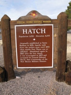
Hatch

Population 1,028  -  Elevation 4,055


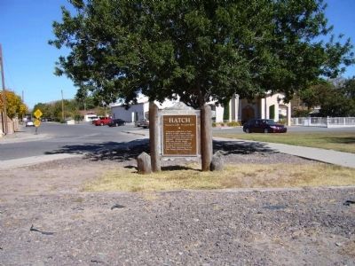
Hatch Marker image. Click for full size.
Photographed By Richard Denney, December 27, 2007
1. Hatch Marker
Inscription. Originally established as Santa Barbara in 1851, Apache raids drove the settlers away until 1853 when nearby Fort Thorn was established. Abandoned again in 1860 after the fort closed, it was reoccupied in 1875 and re-named for General Edward Hatch, then Commander of the New Mexico Military District.
 
Topics and series. This historical marker is listed in these topic lists: Forts and CastlesNative AmericansSettlements & Settlers. In addition, it is included in the El Camino Real de Tierra Adentro series list. A significant historical year for this entry is 1851.
 
Location. 32° 39.95′ N, 107° 9.61′ W. Marker is in Hatch, New Mexico, in Doņa Ana County. Touch for map. Marker is in this post office area: Hatch NM 87937, United States of America. Touch for directions.
 
Other nearby markers. At least 1 other marker is within 6 miles of this marker, measured as the crow flies. Rincón (approx. 5.6 miles away).
 
Also see . . .
1. Official web site for the Village of Hatch, New Mexico, U.S.A. Hatch is known as the "Chile Capital of the World" and the "New Gateway to Space." (Submitted on November 24, 2009.) 

2. Wikipedia entry for General Edward Hatch. (Submitted on November 24, 2009.)
 
Paid Advertisement
Click on the ad for more information.
Please report objectionable advertising to the Editor.
Click or scan to see
this page online
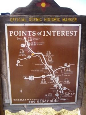
Rear of Hatch Marker image. Click for full size.
Photographed By Bill Kirchner, November 5, 2010
2. Rear of Hatch Marker
Hatch Marker image. Click for full size.
Photographed By Bill Kirchner, November 5, 2010
3. Hatch Marker
Hatch, New Mexico image. Click for full size.
Photographed By Richard Denney
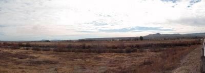
4. Hatch, New Mexico
View coming into Hatch from State Route 543 as it crosses the Rio Grande north of town. Organ Mountains near Las Cruces visible on distant horizon to left.
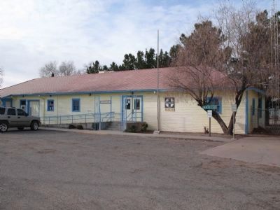
Hatch library utilizes old Santa Fe rail station image. Click for full size.
Photographed By Richard Denney, December 27, 2007
5. Hatch library utilizes old Santa Fe rail station
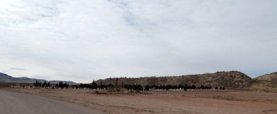
Hatch cemetery image. Click for full size.
Photographed By Richard Denney, December 27, 2007
6. Hatch cemetery
 
 
Credits. This page was last revised on November 25, 2019. It was originally submitted on November 22, 2009, by Richard Denney of Austin, Texas. This page has been viewed 1,779 times since then and 86 times this year. Photos:   1. submitted on November 22, 2009, by Richard Denney of Austin, Texas.   2, 3. submitted on November 19, 2010, by Bill Kirchner of Tucson, Arizona.   4, 5, 6. submitted on November 22, 2009, by Richard Denney of Austin, Texas. • Kevin W. was the editor who published this page.
Share this page.  
Share on Tumblr
m=24745

CeraNet Cloud Computing sponsors the Historical Marker Database.
This website earns income from purchases you make after using our links to Amazon.com. We appreciate your support.
Paid Advertisement
Apr. 26, 2024