Max Meadows in Wythe County, Virginia — The American South (Mid-Atlantic)
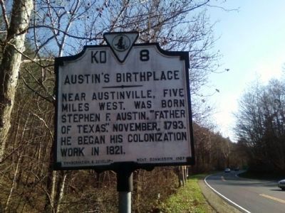
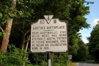
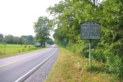
Austin's Birthplace
Erected 1937 by Conservation & development Commission. (Marker Number KD--8.)
Topics and series. This historical marker is listed in this topic list: Settlements & Settlers. In addition, it is included in the Virginia Department of Historic Resources (DHR) series list. A significant historical year for this entry is 1793.
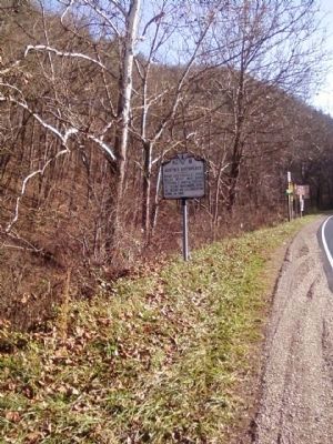
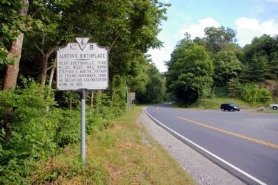
Location. Marker has been reported missing. It was located near 36° 50.975′ N, 80° 51.41′ W. Marker was in Max Meadows, Virginia, in Wythe County. Marker was on Fort Chriswell Road (U.S. 52) just north of Lead Mine Road (Virginia Route 69). Touch for map. Marker was at or near this postal address: 4965 Fort Chriswell RD, Austinville VA 24312, United States of America. Touch for directions.
Other nearby markers. At least 8 other markers are within 2 miles of this location, measured as the crow flies. Stephen F. Austin's Birthplace (a few steps from this marker); Carroll County / Wythe County (about 400 feet away, measured in a direct line); River Crossing Old & New (approx. 1.6 miles away); Jackson's Ferry (approx. 1.6 miles away); History of the Shot Tower (approx. 1.6 miles away); Shot Tower at Jackson's Ferry (approx. 1.6 miles away); Shot Tower Historical State Park (approx. 1.6 miles away); Jackson’s Ferry and Shot Tower (approx. 1.8 miles away).
Related marker. Click here for another marker that is related to this marker.
Photographed By Allen C. Browne, August 9, 2015
6. Stephen F. Austin
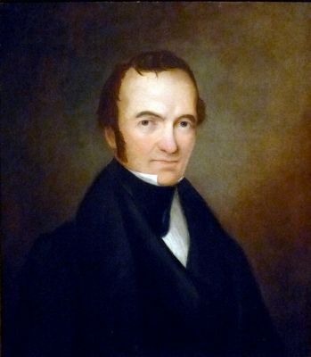
This undated portrait of Stephen F. Austin by an unknown artist hangs in the National Portrait Gallery in Washington, DC.
“In 1822, Stephen F. Austin led a group of AngloAmerican emigrants to settle a site in Texas on the Gulf of Mexico. He gained the cooperation and trust of the newly formed Mexican state, which saw Austin's colony as a way to settle and improve its lands. For ten years Austin led the colony and grew to believe that Mexico, not the United States, should control Texas. However, his hand was forced when the Mexican government, fearing the American colonists' independence, began to harass them. Austin was arrested in 1835 for allegedly plotting to annex Texas from Mexico. Released, he joined the subsequent revolt as commander of the army of Texas. After the declaration of the Republic of Texas (1836), Austin was defeated as its first president by Sam Houston, the war's military hero.” — National Portrait Gallery
“In 1822, Stephen F. Austin led a group of AngloAmerican emigrants to settle a site in Texas on the Gulf of Mexico. He gained the cooperation and trust of the newly formed Mexican state, which saw Austin's colony as a way to settle and improve its lands. For ten years Austin led the colony and grew to believe that Mexico, not the United States, should control Texas. However, his hand was forced when the Mexican government, fearing the American colonists' independence, began to harass them. Austin was arrested in 1835 for allegedly plotting to annex Texas from Mexico. Released, he joined the subsequent revolt as commander of the army of Texas. After the declaration of the Republic of Texas (1836), Austin was defeated as its first president by Sam Houston, the war's military hero.” — National Portrait Gallery
Credits. This page was last revised on July 15, 2023. It was originally submitted on November 29, 2009, by Stanley and Terrie Howard of Greer, South Carolina. This page has been viewed 1,350 times since then and 113 times this year. Photos: 1, 2. submitted on November 29, 2009, by Stanley and Terrie Howard of Greer, South Carolina. 3, 4, 5. submitted on July 2, 2010, by David Seibert of Sandy Springs, Georgia. 6. submitted on October 17, 2015, by Allen C. Browne of Silver Spring, Maryland. • Kevin W. was the editor who published this page.
