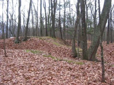
Near Mechanicsburg in Hampshire County, West Virginia — The American South (Appalachia)
The Central Redoubt
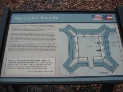
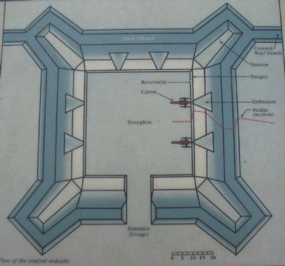
A redoubt is a small enclosed earthwork used to fortify a position from attacks on all sides. The square is the most common form for a redoubt in part due to the ease with which it is constructed. The weakest point of a square redoubt is the corner, or salient, as only a limited amount of fire can be concentrated in that direction. The corner projections, or traverses, of the central redoubt are intended to help overcome that weakness. With these projections, the redoubt has the form of a miniature bastion fort.
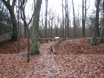
The central redoubt is specifically positioned along the crest of the ridge to dominate the gap in Mill Creek Mountain to the west. The east side of the redoubt dominates the river valley, while the south side defends against potential Confederate infantry attack down the ridgeline from the south. At the time it was constructed, there were few trees on the ridge. What trees existed were probably cleared and used in the construction of the redoubt.
Tues 24. I was on gard at the battery tonight. it rained all eaving and all night. the Countersine was Romney. Wed 25. pleasant day. we was hauling timber off the hill to fix our tents. Thurs 26. clear and winday. we raised our tent up on prickkets today.
Diary of Joshua Winters, March, 1863.
Topics. This historical marker is listed in these topic lists: Forts and Castles • War, US Civil. A significant historical year for this entry is 1863.
Location. 39° 19.442′ N, 78° 47.614′ W. Marker is near Mechanicsburg, West Virginia, in Hampshire County. Marker can be reached from Fort Mill Ridge Park Road, on the right when traveling east. Located at trail stop 3 on the tour of Fort Mill Ridge Park. Touch for map. Marker is in this post office area: Burlington WV 26710, United States of America. Touch for directions.
Other nearby markers. At least 8 other markers are within walking distance of this marker. Interior of the Central Redoubt (a few steps from this marker); Construction of Fort Mill Ridge (within shouting distance of this marker); Control of the Mechanicsburg Gap (within shouting distance of this marker); The Civil War in the South Branch Valley (within shouting distance of this marker); Engagement with McNeill's Rangers (within shouting distance of this marker); Fort Mill Ridge (within shouting distance of this marker); An Outpost in Enemy Territory (within shouting distance of this marker); Abandonment of Fort Mill Ridge (about 300 feet away, measured in a direct line). Touch for a list and map of all markers in Mechanicsburg.
More about this marker. On the right is a plan diagram of the central redoubt. The scale diagram shows locations of the features of the redoubt.
Credits. This page was last revised on June 16, 2016. It was originally submitted on December 7, 2009, by Craig Swain of Leesburg, Virginia. This page has been viewed 1,049 times since then and 12 times this year. Photos: 1, 2, 3, 4, 5. submitted on December 7, 2009, by Craig Swain of Leesburg, Virginia.
