Monroe in Fairfield County, Connecticut — The American Northeast (New England)
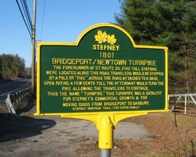
Bridgeport / Newtown Turnpike
1801
Bridgeport / Newtown Turnpike
Stepney Heritage Trail – The Sippin Family
Erected by The Save Our Stepney Task Force.
Topics. This historical marker is listed in these topic lists: Industry & Commerce • Roads & Vehicles. A significant historical year for this entry is 1801.
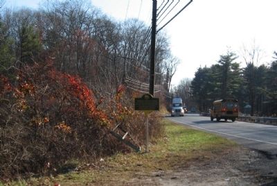
Location. 41° 18.997′ N, 73° 15.631′ W. Marker is in Monroe, Connecticut, in Fairfield County. Marker is on Main Street (Connecticut Route 25) 0.1 miles north of Knollwood Street, on the right when traveling north. Touch for map. Marker is in this post office area: Monroe CT 06468, United States of America. Touch for directions.
Other nearby markers. At least 8 other markers are within 2 miles of this marker, measured as the crow flies. Birdsey’s Plain / Stepney Cemetery (approx. 0.4 miles away); Birdsey’s Plain Stepney Baptist Church (approx. 0.4 miles away); Original Bell of Stepney Baptist Church (approx. 0.4 miles away); Birdsey’s Plain Methodist Church (approx. 0.4 miles away); Monroe World War I Memorial (approx. 0.4 miles away); Burr Hawley & Burritt General Store (approx. half a mile away); Stepney Schoolhouse (approx. 0.9 miles away); Stepney Fire House #1 (approx. 1.2 miles away). Touch for a list and map of all markers in Monroe.
Also see . . . Bridgeport and Newtown Turnpike. (Submitted on December 10, 2009, by Michael Herrick of Southbury, Connecticut.)
Credits. This page was last revised on June 16, 2016. It was originally submitted on December 10, 2009, by Michael Herrick of Southbury, Connecticut. This page has been viewed 1,223 times since then and 30 times this year. Photos: 1, 2. submitted on December 10, 2009, by Michael Herrick of Southbury, Connecticut. • Bill Pfingsten was the editor who published this page.

