University South in Palo Alto in Santa Clara County, California — The American West (Pacific Coastal)
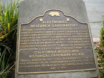
Electronics Research Laboratory
Inscription.
Original site of the laboratory and factory of Federal Telegraph Company, founded in 1909 by Cyril F. Elwell. Here, with two assistants, Dr. Lee de Forest, inventor of the three-element radio vacuum tube, devised in 1911-13 the first vacuum tube amplifier and oscillator. World-wide developments based on this research led to modern radio communication, television, and the electronics age.
Erected 1970 by State Department of Parks & Recreation, Palo Alto Historical Association, City of Palo Alto. (Marker Number 836.)
Topics and series. This historical marker is listed in these topic lists: Communications • Industry & Commerce • Science & Medicine. In addition, it is included in the California Historical Landmarks series list. A significant historical year for this entry is 1909.
Location. 37° 26.484′ N, 122° 9.468′ W. Marker is in Palo Alto, California, in Santa Clara County. It is in University South. Marker is at the intersection of Channing Avenue and Emerson Street on Channing Avenue. Maker on concrete base at the southeast corner of intersetion of Channing Ave. & Emerson St. near downtown Palo Alto. Touch for map. Marker is in this post office area: Palo Alto CA 94301, United States of America. Touch for directions.
Other nearby markers. At least 8 other markers are within walking distance of this marker. Birthplace of “Silicon Valley” (approx. 0.2 miles away); Hostess House (approx. 0.4 miles away); History of Tower Well (approx. 0.6 miles away); San Francisquito Creek Watershed (approx. 0.8 miles away); The Gordon Hampton Oak (approx. 0.8 miles away); a different marker also named San Francisquito Creek Watershed (approx. 0.8 miles away); El Palo Alto (approx. 0.8 miles away); Early People of the Creek (approx. 0.8 miles away). Touch for a list and map of all markers in Palo Alto.
Additional keywords. Pioneer Laboratories, Eletronics
Credits. This page was last revised on February 7, 2023. It was originally submitted on September 20, 2007, by Mathew H. Kohnen of San Jose, California. This page has been viewed 1,972 times since then and 26 times this year. Photo 1. submitted on September 20, 2007, by Mathew H. Kohnen of San Jose, California. • J. J. Prats was the editor who published this page.
