Burnet in Burnet County, Texas — The American South (West South Central)
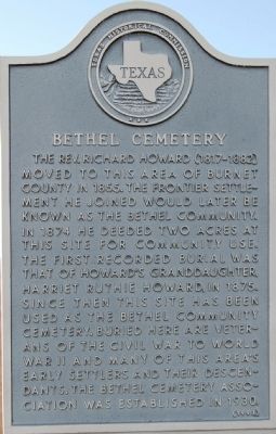
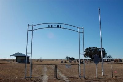
Bethel Cemetery
The Rev. Richard Howard (1817-1882) moved to this area of Burnet County in 1855. The frontier settlement he joined would later be known as the Bethel community. In 1874 he deeded two acres at this site for community use. The first recorded burial was that of Howard's granddaughter, Harriet Ruthie Howard, in 1875. Since then this site has been used as the Bethel Community Cemetery. Buried here are veterans of the Civil War to World War II and many of this area's early settlers and their descendants. The Bethel Cemetery Association was established in 1930.
Erected 1993 by Texas Historical Commission. (Marker Number 9697.)
Topics. This historical marker is listed in this topic list: Cemeteries & Burial Sites. A significant historical year for this entry is 1855.
Location. 30° 51.45′ N, 98° 9.79′ W. Marker is in Burnet, Texas, in Burnet County. Marker can be reached from CR-202. Touch for map. Marker is in this post office area: Burnet TX 78611, United States of America. Touch for directions.
Other nearby markers. At least 8 other markers are within 8 miles of this marker, measured as the crow flies. Lake Victor Lodge No. 1011, A. F. & A. M. (approx. 4 miles away); Site of Town of Strickling (approx. 4 miles away); Black's Fort (approx. 5.1 miles away); Shady Grove Community (approx. 5˝ miles away); Mr. and Mrs. Jacob Wolf (approx. 6.8 miles away); Dobyville Cemetery (approx. 6.8 miles away); The Russell-McFarland Homestead (approx. 7.6 miles away); Airy Mount Barn (approx. 7.6 miles away). Touch for a list and map of all markers in Burnet.
Also see . . . Bethel Cemetery. Hosted by www.cemeteries-of-tx.com (Submitted on February 12, 2010, by Keith Peterson of Cedar Park, Texas.)
Credits. This page was last revised on November 24, 2020. It was originally submitted on February 12, 2010, by Keith Peterson of Cedar Park, Texas. This page has been viewed 927 times since then and 33 times this year. Photos: 1, 2, 3, 4. submitted on February 12, 2010, by Keith Peterson of Cedar Park, Texas. • Bill Pfingsten was the editor who published this page.


