Stevenson in Jackson County, Alabama — The American South (East South Central)
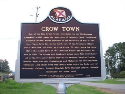
Crow Town
Side A
One of the Five Lower Towns established by the Chickamauga Cherokees in 1782 under the leadership of Dragging Canoe. Territorial Governor William Blount reported to the Secretary of War in 1792 that: “Crow Town lies on the north side of the Tennessee (River), half a mile from the river, up Crow Creek, 30 miles below the Suck. (It) is the lowest town in the Cherokee Nation and contained 30 huts in 1790. The Creeks and Northward tribes cross (the river) here.”
All of the Five Lower Towns were on the extreme Cherokee frontier. Running Water was near Chattanooga and Nickajack was near Haletown, Tennessee. Long Island Town was twenty miles below the Suck, east of Bridgeport, Alabama. Lookout Mountain Town was near Trenton, Georgia.
(Continued on other side)
Side B
Crow Town encompassed an area of several miles by the early 1800s as increasing numbers of Cherokee families settled here. With the creation of Jackson County in 1819, many of the Cherokees moved to the south side of the river – some 19th-century maps placed Crow Town near the southeast end of Snodgrass Bridge which takes Highway 117 across the Tennessee River east of Stevenson. The 1782 site of Crow Town, one-half mile from the confluence of Crow Creek and the original channel of the Tennessee River, was flooded with the closing of the spillway gates at Guntersville Dam in 1939.
Erected 2008 by Sponsored by the Jackson County Historical Association Alabama Historical Association.
Topics and series. This historical marker is listed in these topic lists: Native Americans • Notable Places. In addition, it is included in the Alabama Historical Association series list. A significant historical year for this entry is 1782.
Location. 34° 51.052′ N, 85° 49.494′ W. Marker is in Stevenson, Alabama, in Jackson County. Marker is at the intersection of U.S. 72 and Kentucky Ave. on U.S. 72. Located on left side of Hwy 72 past Stevenson Al at intersections of hwy 72/2/Lee Hwy and Cr 117/Kentucky Ave. Touch for map. Marker is in this post office area: Stevenson AL 35772, United States of America. Touch for directions.
Other nearby markers. At least 8 other markers are within 9 miles of this marker, measured as the crow flies. Bennett's Cove Cabin (approx. half a mile away); Wet, Wild, and Wonderful (approx. half a mile away); Fort Harker (approx. 1.1 miles away); Flight 800 Memorial (approx. 1.3 miles away); Stevenson Depot and Hotel (approx. 1˝ miles away); Averyville (approx. 1.6 miles away); Union Army Headquarters (approx. 1.7 miles away); Rocky Springs Church of Christ (approx. 8.4 miles away). Touch for a list and map of all markers in Stevenson.
Credits. This page was last revised on June 16, 2016. It was originally submitted on March 10, 2010, by Sandra Hughes Tidwell of Killen, Alabama, USA. This page has been viewed 5,183 times since then and 259 times this year. Photos: 1, 2. submitted on March 10, 2010, by Sandra Hughes Tidwell of Killen, Alabama, USA. • Bill Pfingsten was the editor who published this page.

