Stillwater in Saratoga County, New York — The American Northeast (Mid-Atlantic)
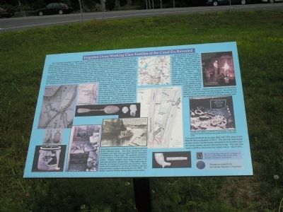
Forgotten Lives; Working Class Families of the Canal Era Revealed
Inscription.
The Champlain Canal/Bemis Heights site is a residential site first occupied during the 1830s soon after the construction of the Champlain Canal. The highway (NY 32) was developed during the eighteenth century as a north-south passage between the heights to the west and the Hudson River on the east. The area was named after John Bemis, who built and operated a tavern to the north of the site in 1762 to service travelers on the road between Fort Edward and Albany. During the American Revolution, General Knox transported artillery along this passage. In 1777 the American Army passed by this way as it prepared for the Battle of Saratoga in the highlands to the northwest.
In the early 1820s construction on the Champlain Canal was complete. The Canal’s prism was built along the highway’s original alignment at its crossing with Devil’s Creek. By 1830 the hamlet was sparsely populated with a few farmsteads. A single building was located at the southern end of the site. By the mid nineteenth century the hamlet had grown in contrast to the surrounding community. Members of the community worked as artisans within their homes, labored on farms or worked as canal boatmen. Eliza Valentine, a weaver, lived with her daughters and two borders on a half-acre parcel in the northern part of the site from 1856 to 1864. In 1864 Seneca Poucher, a boatman and laborer, his wife, children, and the McGowan family lived in the former Valentine home. Joseph Darrow, his wife and children lived in the southern portion of the site while operating a shoe shop. In the 1870s the canal was enlarged to a width of 42 to 46 feet and a depth of 5 feet, causing the removal of the former Darrow house in the southern portion of the site. Throughout the remainder of the nineteenth century the northern portion of the site was home to working class families.
Henry Heiden, a German immigrant, purchased the property in 1895. Heiden operated a blacksmith shop in the mid portion of the site. The shop operated into the 1900s and ceased operation around 1917 when the Champlain Canal was abandoned and replaced by the current Champlain Barge Canal. Around 1906 Heiden built a two story dwelling north of the former Valentine home where he, his new wife, and elderly father lived. Henry Heiden’s blacksmith shop was a simple building resting upon a small cobblestone wall. Investigations within the shop’s interior provided evidence of its layout. Features were associated with the smith’s large forge, anvil, quenching barrel, and scrap pile. These finds have provided valuable information about the blacksmith’s trade, and integral profession in the growth of a small community along the canal.
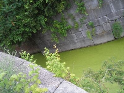
The canal remained as an open ditch until 1954 when it was filled for the construction of US 4. The site was abandoned and the former residence was relocated to the southern portion of the hamlet, where it still stands today. This sign was made in 2005 to document this historic site (c. 1920-1854).
Excavations conducted in 2004 by the NYSM located the former Valentine house. This study uncovered a stone foundation and cellar hole associated with the occupation of the site from c. 1850 to 1906. The foundation pictured on the left, framed a 14 ft by 26 ft cellar, 5 ft below the ground’s surface. Wooden stringers found along the base of the cellar wall supported a planked floor. These cellar areas allowed for the storage of vegetables and preserves. Excavations also revealed that a 40 ft by 26 ft addition was built along the cellar’s southern wall during the mid 1860s. The addition rested on shallow footings above a crawl space.
Erected 2005 by New York State Museum, University of the State of New York, NY State Education Dept.
Topics. This historical marker is listed in these topic lists: Settlements & Settlers • Waterways & Vessels. A significant historical year for this entry is 1762.
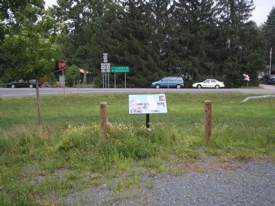
Location. 42° 58.268′ N, 73° 38.014′ W. Marker is in Stillwater, New York, in Saratoga County. Marker is at the intersection of U.S. 4 and New York State Route 32, on the

Photographed By Bill Coughlin, July 13, 2008
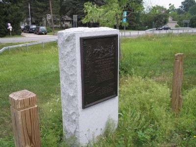
3. Gen. Henry Knox Trail Marker
As stated on the marker, Gen. Henry Knox passed this location while transporting cannons from Fort Ticonderoga to Gen. Washington in Cambridge, Mass. This monument, located near the marker, is one of a series of markers located throughout the states of New York and Massachusetts.
Other nearby markers. At least 8 other markers are within walking distance of this marker. Gen. Henry Knox Trail (here, next to this marker); Earthworks (within shouting distance of this marker); Water Battery (approx. ¼ mile away); American River Fortifications (approx. 0.7 miles away); Thaddeus Kosciusko (approx. 0.7 miles away); American River Defense (approx. 0.7 miles away); Patriots’ Eye-View (approx. 0.7 miles away); Redoubt (approx. 0.7 miles away). Touch for a list and map of all markers in Stillwater.
More about this marker. A number of photos and illustrations appear on the marker. At the center are two maps; one showing the geographic location of the site, and a more detailed map of the area. The left of the marker contains a layout of the site with the caption “Blecker A waster weir was built at the site’s southern boundary along the channel of the Devil’s Creek. This feature helped maintain a desirable water level within the canal’s prism by controlling the quantity of water allowed to flow out of the canal into the Hudson.” Elsewhere on the marker are photos of excavations of the site and artifacts found there. One has a caption of “Pictured are artifacts consisting of horseshoes, nails,
tools, wagon and harness parts and scrap metal discarded by the blacksmith.” A copy of an early 18th century postcard appears on the marker. It has a caption of “Postcard depicting the Anna, the first tugboat used in the Champlain Canal. The site is located along the northern bank of the canal as depicted on the left side of the photo.” A picture of a blacksmith at work is also on the marker.
Credits. This page was last revised on June 16, 2016. It was originally submitted on March 14, 2010, by Bill Coughlin of Woodland Park, New Jersey. This page has been viewed 1,059 times since then and 63 times this year. Photos: 1, 2, 3, 4. submitted on March 14, 2010, by Bill Coughlin of Woodland Park, New Jersey.


